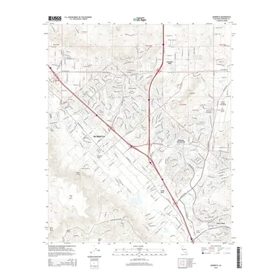
2015 Map of Murrieta
USGS Topo · Published 2015About this map
Murrieta and the surrounding Temecula Valley are shown here during a period of significant suburban expansion in Riverside County. The landscape is defined by the convergence of Murrieta Creek and Warm Springs Creek, which carve through the valley floor beneath the Antelope Hills and the Hogbacks. The map documents the residential development of Linda Rose and Lake Village, juxtaposed against established landmarks like the Laurel Cemetery.
Find a feature on this map
327 named features on this map. Tap any name to fly to it.
Don’t see what you’re looking for? This feature index may not catch every label — zoom into the map to look around manually.
Map Details
Editions of this 2015 Murrieta Map
This is the sole edition of this map. No revisions or reprints were ever made.
Other maps of this area

1901 · Southern California Sheet No. 1
USGS Topo · 1:250,000

1901 · Elsinore
USGS Topo · 1:125,000

1901 · San Luis Rey
USGS Topo · 1:125,000

1904 · Southern California Sheet No. 2
USGS Topo · 1:250,000

1904 · Southern California Sheet No. 1
USGS Topo · 1:250,000

1941 · Margarita Peak
USGS Topo · 1:62,500

1942 · Lake Elsinore
USGS Topo · 1:62,500

1942 · Margarita Peak
USGS Topo · 1:62,500

1942 · Temecula
USGS Topo · 1:62,500

1942 · Murrieta
USGS Topo · 1:62,500