
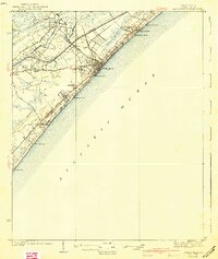
1990 Map of Myrtle Beach
USGS Topo · Published 1990About this map
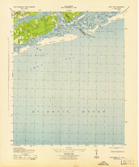
Myrtle Beach Air Force Base and the expansive coastline of the Grand Strand anchor this 1990 survey of the border region between South Carolina and North Carolina. The map documents the dense string of beach communities, from Surfside Beach and Garden City Beach in the south, up through Cherry Grove Beach and across the state line to the barrier islands. In contrast to the developed shore, the interior is defined by the winding Waccamaw River and a complex network of coastal wetlands including Rice Patch Bay, Bear Swamp, and Cawcaw Swamp. The Intracoastal Waterway cuts a straight line behind the coast, facilitating maritime traffic through the Little River region. Further east, the map details the mouth of the Cape Fear River and the strategic location of Fort Caswell on Bald Head Island. This edition captures the area just as the military installation was nearing its final years of active operation, providing a clear picture of the region's late-century coastal infrastructure.
Find a feature on this map
112 named features on this map. Tap any name to fly to it.
Don’t see what you’re looking for? This feature index may not catch every label — zoom into the map to look around manually.
Map Details
Editions of this 1990 Myrtle Beach Map
This is the sole edition of this map. No revisions or reprints were ever made.
Other maps of this area
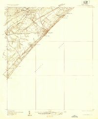
1937 · Myrtle Beach
USGS Topo · 1:48,000
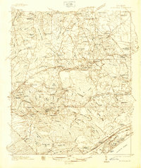
1937 · Nixonville
USGS Topo · 1:48,000
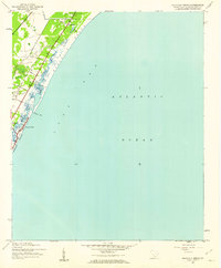
1940 · Myrtle Beach
USGS Topo · 1:62,500

1942 · Nixonville
USGS Topo · 1:62,500

1942 · Wilmington
USGS Topo · 1:62,500

1942 · Cape Fear
USGS Topo · 1:24,000
1942 · Magnolia Beach
USGS Topo · 1:24,000
1943 · Little River
USGS Topo · 1:31,680

1943 · Pireway
USGS Topo · 1:31,680
1943 · Calabash
USGS Topo · 1:31,680