2024 Map of Myrtle
USGS Topo · Published 2024About this map
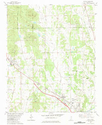
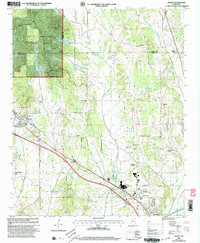
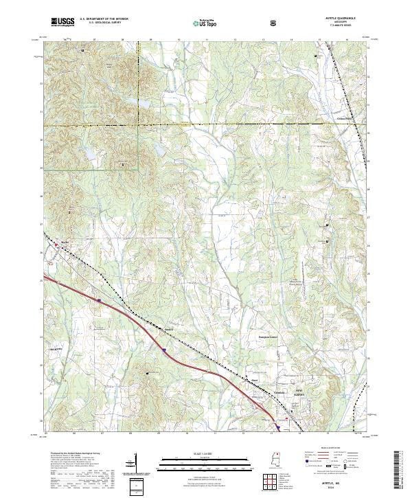
The Holly Springs National Forest covers the northwestern corner of this quadrangle, where the Heipsy Hills rise above a landscape defined by many small creek systems and rural cemeteries. The town of Myrtle serves as a central hub, while the presence of Old Myrtle to the southwest indicates a shift in the local center of gravity over time. The BNSF Railway corridor cuts through the southern portion of the map, passing through Smalco and near the developing outskirts of New Albany. Small agricultural communities and landmarks like Cotton Plant, Pumpkin Center, and Shari are scattered throughout the region, connected by an extensive network of county roads. Genealogists will find several family-named burial grounds, including McAllister Cem and Guyton Cem, often located near the headwaters of streams like Damnation Creek and Jasper Creek.
Find a feature on this map
117 named features on this map. Tap any name to fly to it.
Don’t see what you’re looking for? This feature index may not catch every label — zoom into the map to look around manually.
Map Details
Editions of this 2024 Myrtle Map
This is the sole edition of this map. No revisions or reprints were ever made.