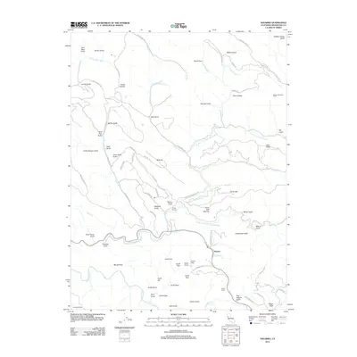
2012 Map of Navarro
USGS Topo · Published 2012About this map
Navarro stands as a focal point in this 2012 survey, situated along the Navarro River where the N Fork Navarro River joins from the north. The landscape is defined by an intricate network of deep gulches and ridges that speak to the area's history of timber and ranching. Private holdings such as the Royale Redwoods Ranch, Ingram Ranch, and Fashauer Ranch are spread across the terrain, while former logging and camp sites like Camp Navarro and Camp Sixteen Gulch indicate the long-standing industrial use of these hills.
Find a feature on this map
83 named features on this map. Tap any name to fly to it.
Don’t see what you’re looking for? This feature index may not catch every label — zoom into the map to look around manually.
Map Details
Editions of this 2012 Navarro Map
This is the sole edition of this map. No revisions or reprints were ever made.
Other maps of this area

1920 · Glenblair
USGS Topo · 1:62,500

1922 · Willits
USGS Topo · 1:62,500

1942 · Willits
USGS Topo · 1:62,500

1943 · Glenblair
USGS Topo · 1:62,500

1943 · Boonville
USGS Topo · 1:62,500

1943 · Navarro
USGS Topo · 1:62,500

1944 · Willits
USGS Topo · 1:62,500

1944 · Saddle Point
USGS Topo · 1:62,500

1957 · Ukiah
USGS Topo · 1:250,000
1959 · Boonville
USGS Topo · 1:62,500