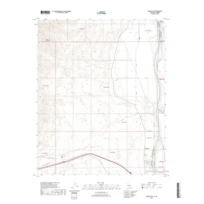
2018 Map of Needles NW
USGS Topo · Published 2018About this map
The Colorado River defines the eastern edge of this landscape, carving a boundary between San Bernardino County, California and Mohave County, Arizona. The settlement of Needles occupies the river’s western bank, serving as a gateway to the arid expanse of the Mojave Desert and the Dead Mountains. The map reveals a transition from the riparian environment of the Mohave Valley to the dry, broad floor of Piute Valley. Transport history is visible through the National Old Trails Hwy and the Railroad Access Rd, which skirt the southern reaches near the railroad stop at Java. Farther north, the drainage of Piute Wash cuts through the desert floor, leading toward the foothills where Red Spring provides a rare water source in the high desert terrain.
Find a feature on this map
43 named features on this map. Tap any name to fly to it.
Don’t see what you’re looking for? This feature index may not catch every label — zoom into the map to look around manually.
Map Details
Editions of this 2018 Needles NW Map
This is the sole edition of this map. No revisions or reprints were ever made.
Other maps of this area

1886 · Camp Mohave
USGS Topo · 1:250,000

1892 · Camp Mohave
USGS Topo · 1:250,000

1903 · Needles
USGS Topo · 1:125,000

1904 · Needles Special
USGS Topo · 1:125,000

1926 · Mohave City
USGS Topo · 1:96,000

1942 · Camp Mohave
USGS Topo · 1:250,000

1943 · Bannock
USGS Topo · 1:62,500

1947 · Kingman
USGS Topo · 1:250,000

1948 · Kingman
USGS Topo · 1:250,000

1950 · Davis Dam
USGS Topo · 1:62,500