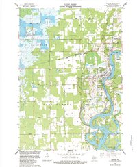
1984 Map of Nekoosa
USGS Topo · Published 1984About this map
The Wisconsin River defines the landscape of south-central Wood County, meandering through a region dominated by the commercial cultivation of Cranberry Bogs. The industrial and social hubs of Nekoosa and Port Edwards are well-established by the mid-1980s, their footprints shaped by the Nekoosa and Port Edwards corporate boundaries. Rail infrastructure remains a critical component of the local economy, with the Chicago Milwaukee St Paul and Pacific and Chicago and North Western lines converging at Nekoosa Junction. This convergence highlights the area's importance as a processing and transport center for the surrounding agricultural and timber lands.
Find a feature on this map
42 named features on this map. Tap any name to fly to it.
Don’t see what you’re looking for? This feature index may not catch every label — zoom into the map to look around manually.
Map Details
Editions of this 1984 Nekoosa Map
This is the sole edition of this map. No revisions or reprints were ever made.
Other maps of this area

1953 · Eau Claire
USGS Topo · 1:250,000

1955 · Green Bay
USGS Topo · 1:250,000

1957 · Wisconsin Rapids
USGS Topo · 1:48,000

1957 · Pittsville
USGS Topo · 1:48,000

1958 · Eau Claire
USGS Topo · 1:250,000

1958 · Arkdale
USGS Topo · 1:48,000

1958 · Necedah
USGS Topo · 1:48,000

1964 · Eau Claire
USGS Topo · 1:250,000

1967 · Arkdale NE
USGS Topo · 1:24,000

1967 · Wisconsin Rapids
USGS Topo · 1:62,500