Old Maps of Wood County, Wisconsin
Explore 196 old maps of Wood County, spanning from 1953 to today. These high-resolution historic maps reveal how streets, neighborhoods, landmarks, and natural features evolved over time — perfect for genealogy, metal detecting, research, and local history exploration.
What you can do with these maps:
- See how Wood County changed over time: Compare historical maps to modern-day views to trace roads, homesites, rail lines & more.
- View detailed metadata: Each map includes creators, publishers, year, scale, and archive source.
- Overlay maps with satellite & LiDAR: Visualize the past alongside modern tools to explore terrain & human change.
- Trusted historical sources: Maps sourced from the USGS, Library of Congress, and other archives.
- Access maps your way: View online, download high-res files, or order prints for personal or research use.
Start exploring old maps of Wood County to uncover forgotten places, hidden landmarks, and the deep history beneath your feet.
Wood County, WI maps
(196)- 1953 Map of Eau Claire, 1965 Print
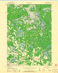
 1953 Eau Claire1965 Print · USGSWest-central Wisconsin in the mid-fifties shows a landscape of river-valley industry and vast wildlife refuges during the transition from rails to modern highways. Genealogists and historians can trace the rail corridors of the Chicago and North Western or locate family-named landmarks like Decorah Mound and Chippewa Island.4 unique versions available
 - 1954 Map of Granton, 1956 Print
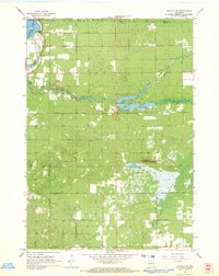
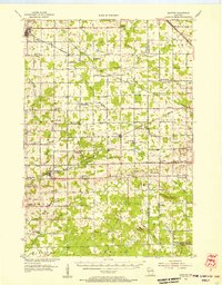 1954 Granton1956 Print · USGSCentral Wisconsin's farming heartland and rural school network are preserved here during the mid-1950s. Genealogists can locate family-named landmarks and institutions like Spokeville Sch, Grace Ch, and the high ground of Lindsey Bluffs.2 unique versions available
 - 1954 Map of Marshfield, 1956 Print
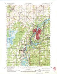
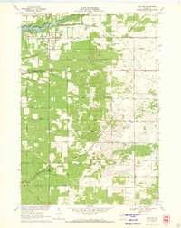
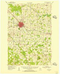 1954 Marshfield1956 Print · USGSMarshfield and the surrounding Wood County dairy lands are captured here in the mid-fifties as the city evolved into a major regional medical and rail hub. Genealogists can locate family landmarks like St Peters Ch, Trinity Cem, and dozens of rural schoolhouses including Golden Glow Sch.2 unique versions available
 - 1955 Map of Green Bay, 1968 Print
 1955 Green Bay1968 Print · USGSCentral and Eastern Wisconsin are captured here in the mid-fifties, showing the industrial growth of the Fox Valley and Wisconsin River corridors. Genealogists and historians can trace rail lines like the Green Bay and Western through settlements like Weyauwega, Clintonville, and Pulaski.2 unique versions available
 - 1956 Map of Milladore, 1958 Print
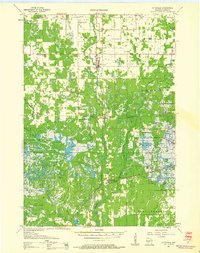
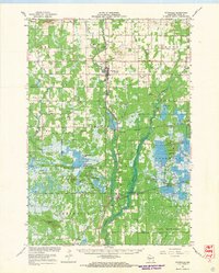
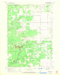
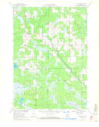
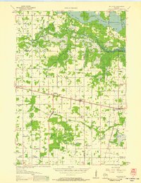 1956 Milladore1958 Print · USGSIn the mid-fifties, this section of Wood County was a busy crossroads for the Soo Line and Milwaukee Road railroads. Genealogists can trace a lost network of rural education through sites like Steppingstone Sch, Lone Elm Sch, and the Runkle Sch.
 - 1956 Map of Stevens Point, 1958 Print
 1956 Stevens Point1958 Print · USGSStevens Point and the central Wisconsin River valley are captured here in the mid-fifties during a period of significant educational and infrastructure growth. Researchers can locate numerous country schools and religious landmarks, from St Francis Ch to the State Teachers College and the Cranberry Bog.2 unique versions available
 - 1957 Map of Wisconsin Rapids, 1959 Print
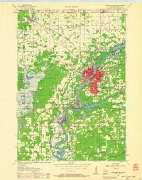 1957 Wisconsin Rapids1959 Print · USGSThe mid-century paper-milling and cranberry-farming corridor along the Wisconsin River is shown here in detail during a period of steady growth. Researchers can trace the development of Wisconsin Rapids, the extensive Cranberry Bogs, and rural landmarks like St Johns Ch and Nepco Lake.
 - 1957 Map of Pittsville, 1959 Print
 1957 Pittsville1959 Print · USGSWood County in the late fifties was a specialized landscape of marshland agriculture and remote rural outposts. Genealogists and historians can trace family-named schools like Wallace Sch, find the Babcock Cem, and locate the expansive Cranberry Bogs.2 unique versions available
 - 1957 Map of Whiting, 1959 Print
 1957 Whiting1959 Print · USGSCentral Wisconsin is captured here in the late fifties, showcasing the river-and-rail corridor connecting Whiting and Bancroft. Researchers can trace old rural schoolhouses like Pearl Sch and cemeteries such as McDill Cem across the Portage County landscape.
 - 1957 Map of City Point, 1960 Print
 1957 City Point1960 Print · USGSJackson and Clark Counties are shown here in the late fifties, dominated by the timber and cranberry industries of the Central Wisconsin Sand County. Genealogists and historians can locate rural landmarks like Audubon Sch, Martyrs Cem, and the old rail siding at Spaulding.2 unique versions available
 - 1958 Map of Eau Claire
 1958 Eau Claire1958 Print · USGSWestern Wisconsin in the late fifties shows a landscape of growing regional hubs and massive wildlife refuges. Trace the rail lines of the Chicago and North Western between Eau Claire and Marshfield, or explore the terrain around Iron Mound and Lake Wissota.
 - 1958 Map of Arkdale, 1960 Print
 1958 Arkdale1960 Print · USGSIn the late fifties, the central Wisconsin landscape of Adams County was defined by the massive Petenwell Flowage and rural farming life. Genealogists can trace family names at Violet Lawn Sch, Spring Branch Cem, and the settlement of Arkdale.
 - 1958 Map of Coloma, 1960 Print
 1958 Coloma1960 Print · USGSThe Central Wisconsin sand plains are shown during the late 1950s as small towns like Plainfield and Coloma flourished along the Chicago and North Western rail line. Genealogists can locate rural schoolhouses such as Rathermel Sch and family landmarks like Owens Rock.
 - 1958 Map of Necedah, 1960 Print
 1958 Necedah1960 Print · USGSJuneau County in the late fifties shows a landscape shaped by massive water projects and conservation efforts. Genealogists and hikers can trace old country roads to find the Rockview Sch, Zion Cem, and the tracks of the Chicago and North Western.3 unique versions available
 - 1958 Map of Wyeville, 1960 Print
 1958 Wyeville1960 Print · USGSWisconsin's cranberry and timber country is documented here in the late fifties, centered on the rail junctions of Monroe and Juneau Counties. You can trace the rural infrastructure of the day, from the Indian Cem and St Marks Ch to the Chicago and North Western rail lines.
 - 1964 Map of Eau Claire
 1964 Eau Claire1964 Print · USGSWest-central Wisconsin in the mid-1960s was a hub of river-driven industry and expanding rail networks. Researchers can trace historic homesteads near Menomonie, follow the Soo Line RR through Marshfield, or explore the grounds of the Camp McCoy Military Reservation.
 - 1967 Map of Arkdale NE, 1969 Print
 1967 Arkdale NE1969 Print · USGSCentral Wisconsin in the late 1960s shows a landscape of growing recreational lakes and established rural townships like Rome and Big Flats. Genealogists and local historians can locate Spring Branch Cem, Zion Ch, and the high point at Dorro Couche Lookout Tower.2 unique versions available
 - 1967 Map of Wisconsin Rapids, 1969 Print
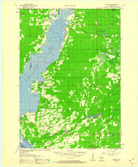
 1967 Wisconsin Rapids1969 Print · USGSThe industrial riverfronts of Wood County and the extensive cranberry marshlands of the central sands are captured in this mid-century survey. Researchers can trace family roots through numerous rural landmarks like St John Ch, Trinity Cem, and the community at Eight Corners.2 unique versions available
 - 1967 Map of Pittsville, 1969 Print
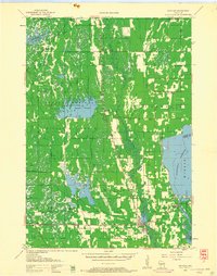
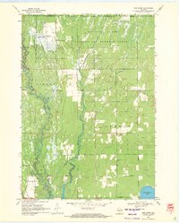
 1967 Pittsville1969 Print · USGSWood County in the late sixties shows a unique landscape of managed wetlands and cranberry production. Genealogists and local historians can trace family sites near Pittsville, find the Cranmoor Sch, or locate cemeteries like St Johns Cem and Babcock Cem.2 unique versions available
 - 1968 Map of Coloma NW, 1971 Print
 1968 Coloma NW1971 Print · USGSAdams County land and the Portage County line are shown here in the late sixties as the rural road grid matured. Genealogists and local historians can locate Holliday Cemetery, Coloma-Leola Cemetery, and landmarks like Owens Rock.2 unique versions available
 - 1969 Map of New Miner, 1971 Print
 1969 New Miner1971 Print · USGSJuneau County was a landscape of specialized land use in the late sixties, from military ranges to wildlife conservation. Researchers can locate the New Miner settlement, several rural burial grounds like Novotny Cem, and the tracks of the M St P & P railroad.2 unique versions available
 - 1969 Map of Finley, 1971 Print
 1969 Finley1971 Print · USGSJuneau County’s wetland interior is documented here in the late sixties, showcasing the vast water management systems of the Necedah National Wildlife Refuge. Researchers can trace the rail corridor of the Chicago Milwaukee St Paul and Pacific and locate local landmarks like Finley and Meadow Valley Cem.
 - 1969 Map of Arkdale NW, 1971 Print
 1969 Arkdale NW1971 Print · USGSThe shorelines of the Wisconsin River define the local landscape during the late sixties, where recreation and military activity exist side-by-side. Trace old landmarks like Cranberry Rock Lookout Tower, the settlement at New Rome, and the expansive National Guard Bombing and Gunnery Range.3 unique versions available
 - 1970 Map of Kellner, 1972 Print
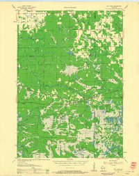
 1970 Kellner1972 Print · USGSThe rural border of Wood and Portage Counties was a landscape of managed waterways and rail lines in the 1970s. Genealogists and local historians can trace the community around Kellner, finding landmarks like St Johns Cem, Grant Sch, and the Church of God.
 - 1970 Map of City Point NE, 1972 Print
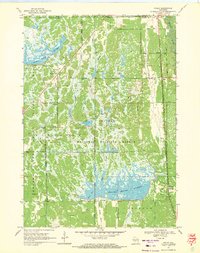
 1970 City Point NE1972 Print · USGSThe Wood County marshlands and the settlement of Sherwood are captured here in the early 1970s. Researchers can trace the drainage of Ammundson Marsh or locate the Cranberry Bog and Sherwood Lake recreation area.2 unique versions available
Showing maps 1-25 of 196
Top cities of Wood County
- Marshfield historical maps
- Wisconsin Rapids historical maps
- Nekoosa historical maps
- Port Edwards historical maps
- Pittsville historical maps
- Biron historical maps
See more
Frequently asked questions
- What are the different types of historical maps available for Wood County?
- What is the oldest map of Wood County?
- Where can I purchase historical maps of Wood County for my home or office?
- Where can I download high-res historical maps of Wood County?
- Are there historical topographic maps available for Wood County?
- Is there historical aerial imagery available for Wood County?
- Where are historical maps of Wood County sourced from?