2022 Map of Ness City
USGS Topo · Published 2022About this map
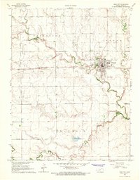
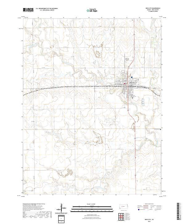
Ness City serves as the focal point of this West Central Kansas survey, situated at the confluence of several branches of the Walnut Creek system. The town grid is clearly defined, anchored by the Ness County Courthouse and extending toward the Ness City Municipal Airport to the north. This topographic study illuminates the agricultural layout of the High Plains, where section lines and rural routes like W 160 RD and 110 RD segment the landscape between shifting creek beds. Notable local history landmarks include the Sacred Heart Cem near the southern edge of the city and the Chenoweth Cem situated to the southeast. The drainage patterns of the N Fork Walnut Cr and S Fork Walnut Cr dominate the local relief, illustrating how water access shaped the development of this county seat.
Find a feature on this map
38 named features on this map. Tap any name to fly to it.
Don’t see what you’re looking for? This feature index may not catch every label — zoom into the map to look around manually.
Map Details
Editions of this 2022 Ness City Map
This is the sole edition of this map. No revisions or reprints were ever made.