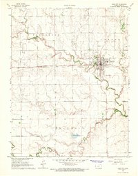
1966 Map of Ness City
USGS Topo · Published 1967About this map
Ness City serves as the focal point of this 1960s landscape, situated at the confluence where the North Fork Walnut Creek and other tributaries join the main Walnut Creek channel. The mid-century development of the town is clearly visible, featuring a local Ness City Airfield, a Drive-in Theater, and a Sewage Disposal plant, reflecting the infrastructure of a growing Kansas county seat. Transport and industry define the area's layout, with the Atchison Topeka and Santa Fe railroad running east-to-west across the plains, while numerous Oil Wells and Gravel Pits are scattered throughout the surrounding townships. Genealogists will find the locations of several burial sites, including Sacred Heart Cem, Chenoworth Cem, and Michler Cem, providing essential keys for family research in Forrester and Franklin townships.
Find a feature on this map
24 named features on this map. Tap any name to fly to it.
Don’t see what you’re looking for? This feature index may not catch every label — zoom into the map to look around manually.
Map Details
Editions of this 1966 Ness City Map
This is the sole edition of this map. No revisions or reprints were ever made.
Other maps of this area

1892 · Ness
USGS Topo · 1:125,000

1893 · Ellis
USGS Topo · 1:125,000

1894 · Ness
USGS Topo · 1:125,000

1955 · Great Bend
USGS Topo · 1:250,000

1955 · Scott City
USGS Topo · 1:250,000

1957 · Great Bend
USGS Topo · 1:250,000

1958 · Great Bend
USGS Topo · 1:250,000

1958 · Scott City
USGS Topo · 1:250,000
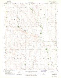
1966 · Ransom SE
USGS Topo · 1:24,000
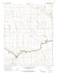
1966 · Ness City NE
USGS Topo · 1:24,000