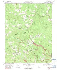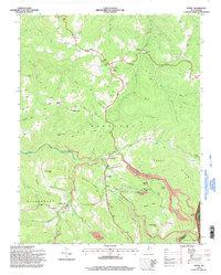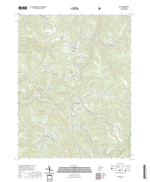
2023 Map of Nettie
USGS Topo · Published 2023About this map
Nettie serves as a central hub for this portion of Nicholas County, where several local routes intersect among the high ridges. The landscape is defined by a dense network of watercourses and topographical landmarks, including Hurricane Ridge and the Middle Ridge that separates the numerous tributaries of Hominy Creek. Small settlements and naming conventions reflect a long history of local residency, with places like Odell Town and Leivasy connected by a web of county roads such as Leivasy Rd and Canvas Nettie Rd.
Find a feature on this map
92 named features on this map. Tap any name to fly to it.
Don’t see what you’re looking for? This feature index may not catch every label — zoom into the map to look around manually.
Map Details
Editions of this 2023 Nettie Map
This is the sole edition of this map. No revisions or reprints were ever made.
Historical Maps of Odell Town Through Time
3 maps found