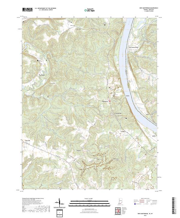
2022 Map of New Amsterdam
USGS Topo · Published 2022About this map
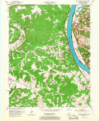
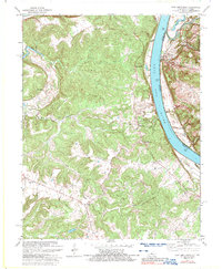
The Ohio River serves as the central artery and dividing line between Harrison County, Indiana, and Meade County, Kentucky. This riverine landscape is defined by the high, undulating ridges that overlook the water, including Buzzard Roost and Turkey Heaven Ridge. In the Indiana portion, the river town of New Amsterdam sits at the base of the bluffs, while across the water in Kentucky, settlements like Battletown and Oolite occupy the heights. Small family and community burial grounds, such as the Figgins Family Cem, Crown Hill Cem, and Haynes Cem, are scattered throughout the hills, providing a dense record of early settlement patterns and genealogical data. The winding course of Wolf Creek and its many forks dissect the Kentucky interior, illustrating the complex drainage systems that once dictated the placement of homesteads and early roadways like Rhodelia Rd.
Find a feature on this map
94 named features on this map. Tap any name to fly to it.
Don’t see what you’re looking for? This feature index may not catch every label — zoom into the map to look around manually.
Map Details
Editions of this 2022 New Amsterdam Map
This is the sole edition of this map. No revisions or reprints were ever made.
Historical Maps of Andyville Through Time
3 maps found