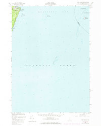
1973 Map of New Harbor
USGS Topo · Published 1974About this map
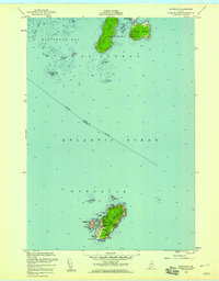
Pemaquid Neck and the village of New Harbor define the western shoreline of this coastal survey, where the terrestrial landscape of the Bristol peninsula meets the expanse of Muscongus Bay. The map provides a detailed look at the maritime hazards and landmarks essential to the local fishing and seafaring economy, including the New Harbor Sunken Ledges and the prominent Daybeacon on Eastern Egg Rock. Inland, the terrain rises toward Lookout Hill, while the coast is marked by inlets like Back Cove and Pumpkin Cove. This 1973 photorevision incorporates updates from aerial photography, offering a precise view of the mid-coast Maine shoreline before the further development of the late 20th century. Notable offshore features such as Moser Ledge and Little Island illustrate the complex underwater topography of the Atlantic Ocean in this region.
Find a feature on this map
18 named features on this map. Tap any name to fly to it.
Don’t see what you’re looking for? This feature index may not catch every label — zoom into the map to look around manually.
Map Details
Editions of this 1973 New Harbor Map
This is the sole edition of this map. No revisions or reprints were ever made.
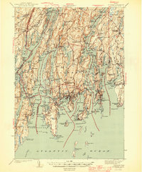
Other maps of this area

1893 · Boothbay
USGS Topo · 1:62,500

1904 · Monhegan
USGS Topo · 1:62,500

1906 · Monhegan
USGS Topo · 1:62,500

1941 · Boothbay
USGS Topo · 1:62,500

1943 · Boothbay
USGS Topo · 1:62,500
1944 · Boothbay
USGS Topo · 1:62,500

1948 · Bath
USGS Topo · 1:250,000
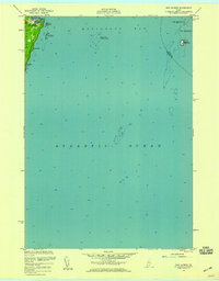
1955 · New Harbor
USGS Topo · 1:24,000
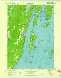
1955 · Louds Island
USGS Topo · 1:24,000
1955 · Monhegan
USGS Topo · 1:24,000