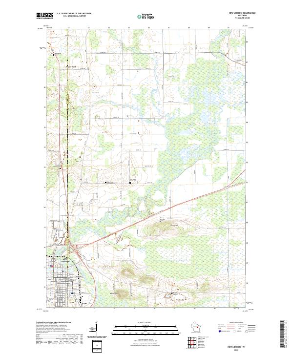
2022 Map of New London
USGS Topo · Published 2022About this map
The confluence of the Embarrass River and Wolf River defines the southern landscape of this Wisconsin region, where the city of New London straddles the county line. The terrain is characterized by expansive wetlands and notable elevations such as Mosquito Hill and Turney Hill, providing a distinct contrast to the surrounding low-lying marshes. The settlement of Sugar Bush anchors the northern portion of the map, connected to the larger hub by a network of rural routes like Co Rd D and Co Rd W.
Find a feature on this map
98 named features on this map. Tap any name to fly to it.
Don’t see what you’re looking for? This feature index may not catch every label — zoom into the map to look around manually.
Map Details
Editions of this 2022 New London Map
This is the sole edition of this map. No revisions or reprints were ever made.
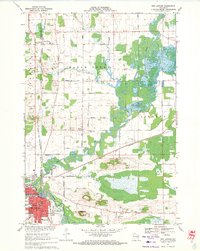
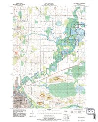
Historical Maps of Lebanon Through Time
4 maps found