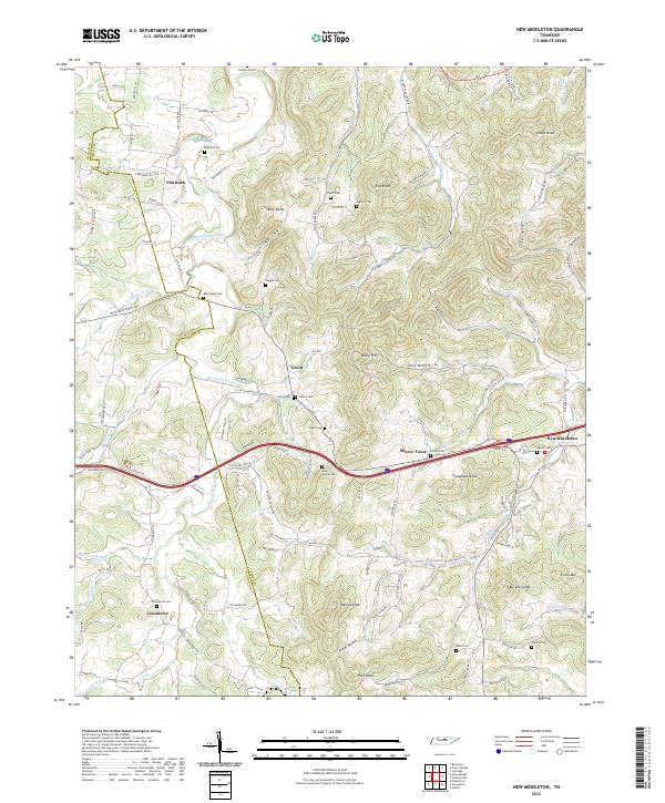
2022 Map of New Middleton
USGS Topo · Published 2022About this map
Round Lick Creek carves through the Smith County hills, defining a landscape of narrow valleys and prominent summits. This terrain is marked by family-named landmarks like Tomahawk Knob, Walnut Knob, and Evans Mtn, while small communities such as New Middleton and Shaver Town occupy the lower elevations along the primary road corridors. The distribution of burial sites, including Bethlehem Cem, Neal-Moore Cem, and Grant Cem, suggests a long-established pattern of rural settlement. In the southern reach of the map, Commerce serves as a local hub near the Wilson and Smith County line. The intricate drainage network, fed by Jennings Fork and Plunkett Creek, underscores the geographic isolation that historically shaped these upland communities before modern infrastructure provided easier access through the hollows.
Find a feature on this map
122 named features on this map. Tap any name to fly to it.
Don’t see what you’re looking for? This feature index may not catch every label — zoom into the map to look around manually.
Map Details
Editions of this 2022 New Middleton Map
This is the sole edition of this map. No revisions or reprints were ever made.
Other maps of this area

1928 · Gordonsville
USGS Topo · 1:62,500

1932 · Carthage
USGS Topo · 1:62,500

1942 · Statesville
USGS Topo · 1:100,000

1956 · Corbin
USGS Topo · 1:250,000

1956 · Nashville
USGS Topo · 1:250,000

1958 · New Middleton
USGS Topo · 1:24,000

1958 · Corbin
USGS Topo · 1:250,000

1958 · Bellwood
USGS Topo · 1:24,000

1958 · Watertown
USGS Topo · 1:24,000

1958 · Dixon Springs
USGS Topo · 1:24,000