2022 Map of New Post
USGS Topo · Published 2022About this map
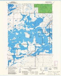
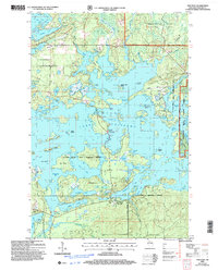
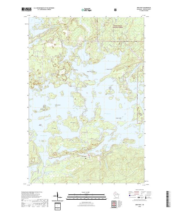
New Post sits as the central settlement in this landscape of intricate waterways and dense timberlands, positioned near the shores of Lake Chippewa. The terrain is defined by the massive Chippewa Flowage, where countless islands such as Pork Barrel Island, Eagles Nest Island, and Big Timber Island emerged following the damming of regional rivers. The map documents a complex shoreline of deep bays and narrows, including Musky Bay and Kavanagh Bay, reflecting the area's transition into a premier destination for northern Wisconsin recreation.
Find a feature on this map
93 named features on this map. Tap any name to fly to it.
Don’t see what you’re looking for? This feature index may not catch every label — zoom into the map to look around manually.
Map Details
Editions of this 2022 New Post Map
This is the sole edition of this map. No revisions or reprints were ever made.
Historical Maps of Ojibwa Through Time
3 maps found