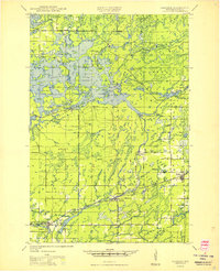
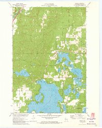
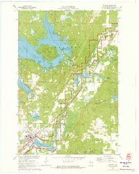
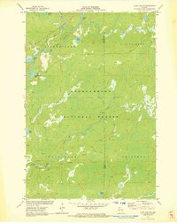
Old Maps of Round Lake, Wisconsin
Explore 42 old maps of Round Lake, spanning from 1942 to today. These high-resolution historic maps reveal how streets, neighborhoods, landmarks, and natural features evolved over time — perfect for genealogy, metal detecting, research, and local history exploration.
What you can do with these maps:
- See how Round Lake changed over time: Compare historical maps to modern-day views to trace roads, homesites, rail lines & more.
- View detailed metadata: Each map includes creators, publishers, year, scale, and archive source.
- Overlay maps with satellite & LiDAR: Visualize the past alongside modern tools to explore terrain & human change.
- Trusted historical sources: Maps sourced from the USGS, Library of Congress, and other archives.
- Access maps your way: View online, download high-res files, or order prints for personal or research use.
Start exploring old maps of Round Lake to uncover forgotten places, hidden landmarks, and the deep history beneath your feet.
Round Lake, WI maps
(42)- 1942 Map of Clam Lake, 1959 Print
 1942 Clam Lake1959 Print · USGSNorthern Wisconsin's deep woods are captured here during the early 1940s, showing the early infrastructure of the Chequamegon National Forest. Researchers can locate the Clam Lake CCC Camp, the NYA Camp, and the Clam Lake Fire Tower among dozens of named lakes and streams.2 unique versions available
 - 1943 Map of Namekagon Lake, 1960 Print
 1943 Namekagon Lake1960 Print · USGSUpper Wisconsin’s lake country is captured here during the mid-1940s, showing a landscape of glacial waters and early forest infrastructure. Researchers can locate remote schools and camps like Spider Lake Sch and the Sawyer CCC Camp or trace the early shoreline of Lost Land Lake.2 unique versions available
 - 1944 Map of Draper, 1952 Print
 1944 Draper1952 Print · USGSLogging and rail transport dominated the Sawyer County timberlands during the mid-forties. Genealogists and historians can locate former homesteads and work sites like Old Le May Camp, Loretta Cem, and the Barber Lake Sch.2 unique versions available
 - 1944 Map of Couderay, 1956 Print
 1944 Couderay1956 Print · USGSSawyer County’s lake country is captured here during the 1940s, showing the intersection of tribal lands and rail-driven settlements. Genealogists and historians can trace old homesteads near Reserve, the village of Couderay, and rural schools like Boylan Sch.2 unique versions available
 - 1944 Map of Radisson, 1957 Print
 1944 Radisson1957 Print · USGSSawyer County in the mid-1940s shows a landscape of timber and rail along the Chippewa River. Local historians can trace the Chicago and North Western Railway through Radisson or locate rural landmarks like Hunter Sch and New Post.2 unique versions available
 - 1944 Map of Hayward, 1965 Print
 1944 Hayward1965 Print · USGSHayward and the northern Wisconsin lake country are captured here at the close of the Second World War. Researchers can trace the Chicago St Paul Minneapolis and Omaha rail line to find vanished schoolhouses like Sabin Sch and the Indian Sch.
 - 1945 Map of Namekagon Lake
 1945 Namekagon Lake1945 Print · USGSThe National Forest of northern Wisconsin is shown here in the mid-1940s as a landscape of timber trails and remote camps. Researchers can locate the Sawyer CCC Camp, the Lost Land Lake Club, and local landmarks like the West Fork Fire Tower.2 unique versions available
 - 1945 Map of Clam Lake
 1945 Clam Lake1945 Print · USGSThe Northwoods of Ashland and Bayfield Counties are captured here in the mid-1940s, centered on the Clam Lake community. Genealogists and historians can locate federal project sites like the Clam Lake CCC Camp and NYA Camp alongside the Clam Lake Fire Tower.2 unique versions available
 - 1947 Map of Draper
 1947 Draper1947 Print · USGSSawyer County is captured here in the late 1940s as its logging history gives way to reforestation and rural settlement. Genealogists can trace family footprints at Loretta Cem, Barber Lake Sch, and various sites like Old Savord Camp.2 unique versions available
 - 1948 Map of Couderay
 1948 Couderay1948 Print · USGSSawyer County at the end of the Second World War shows a landscape defined by its great lakes and a dense network of early railroads. Genealogists and local historians can trace family-named sites and rural centers like Hauer, Whitefish Ch, and Kinnamon Sch.
 - 1949 Map of Radisson
 1949 Radisson1949 Print · USGSSawyer County's timber and rail landscape is captured here in the mid-1940s, showing the early development of the Chippewa River valley. Researchers can trace historic local sites like New Post, the Bishop Bridge Sch, and the Chicago and North Western rail line.
 - 1953 Map of Ashland, 1964 Print
 1953 Ashland1964 Print · USGSNorthern Wisconsin's lakefront and timberlands are seen here in the mid-1950s, showing the intersection of industrial rail lines and vast wilderness. Genealogists and historians can trace the Soo Line through rail towns like Mellen or locate family roots in the Apostle Islands and Bad River Indian Reservation.3 unique versions available
 - 1953 Map of Rice Lake, 1967 Print
 1953 Rice Lake1967 Print · USGSNorthwest Wisconsin during the mid-fifties reveals a landscape defined by timber, rail, and water. Genealogists and historians can trace the development of river towns like Ladysmith and Rice Lake along the Soo Line and Chicago and North Western railroads.2 unique versions available
 - 1958 Map of Ashland
 1958 Ashland1958 Print · USGSCoastal Wisconsin and the Michigan borderlands meet here in the late fifties, dominated by the timbered expanses and iron-rich ranges. Genealogists can trace family footprints in settlements like Odanah and Montreal, or locate landmarks such as the Coast Guard Station and Agricultural Experiment Station.
 - 1959 Map of Rice Lake
 1959 Rice Lake1959 Print · USGSNorthwest Wisconsin in the late fifties was a land of expanding road networks and deep-seated timber history. Genealogists and historians can trace rail lines like the Soo Line RR and Chicago St Paul Minneapolis and Omaha Ry as they link settlements from Spooner to Medford.
 - 1971 Map of Seeley, 1973 Print
 1971 Seeley1973 Print · USGSSawyer County’s lake country is captured here in the early 1970s, just as modern conservation areas were being formalized. Researchers can locate the Seeley settlement and Chicago and North Western railroad alongside the Namekagon River.2 unique versions available
 - 1971 Map of Hayward, 1973 Print
 1971 Hayward1973 Print · USGSThe Hayward area and the upper Namekagon River are shown here in the early 1970s as timber and tourism defined the region. Genealogists and local historians can locate the Indian Cemetery, Trinity Cemetery, and the old rail path of the Chicago and North Western railroad.2 unique versions available
 - 1971 Map of Clam Lake SW, 1973 Print
 1971 Clam Lake SW1973 Print · USGSSawyer and Ashland Counties are shown in the early seventies, a period when the timberlands and waterways remained largely undeveloped. Genealogists and outdoorsmen can trace the drainage of the West Fork Chippewa River past Shanagolden and Kelly Lake.2 unique versions available
 - 1971 Map of Chief Lake, 1973 Print
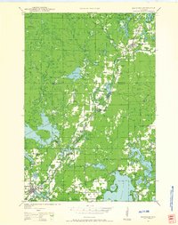
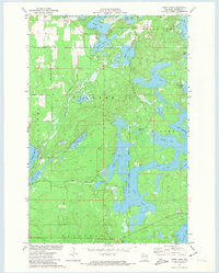 1971 Chief Lake1973 Print · USGSSawyer County’s glacial lake country is captured here in the early 1970s, showcasing the intersection of tribal lands and Northwoods recreation. Genealogists and local historians can locate the Round Lake Cem and trace old routes like Trepania Road and Gurno Road.
 - 1971 Map of Blaisdell Lake, 1973 Print
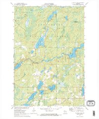 1971 Blaisdell Lake1973 Print · USGSSawyer County’s Northwoods were a secluded network of glacial lakes and river bends in the early seventies. Genealogists and local historians can trace legacy sites like the Wa-Ha-Kee Church Camp and Glenwood Camp or the path of the regional Snowmobile Trail.2 unique versions available
 - 1971 Map of Spider Lake, 1973 Print
 1971 Spider Lake1973 Print · USGSSawyer County’s glacial lakeland is shown in detail during the early 1970s, as the Chequamegon National Forest was being managed for conservation and recreation. Local researchers can trace family-named landmarks like Davies Lake and Currier Lake or locate the historic Townhall and Tiger Cat Dam.
 - 1972 Map of Barker Lake, 1974 Print
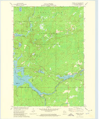 1972 Barker Lake1974 Print · USGSThe Chippewa River forks meet in Sawyer County during the early 1970s, where the national forest meets tribal lands. Trace the complex shoreline of Lake Chippewa to find Wagon Wheel Island, the Winter Dam, and isolated spots like Venison Spring.2 unique versions available
 - 1972 Map of New Post, 1975 Print
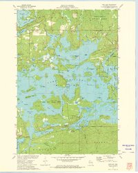 1972 New Post1975 Print · USGSThe Northwoods of Sawyer County are shown in the early seventies as a dense landscape of interconnected glacial lakes and managed timberlands. Researchers can locate family landmarks like Hermans Landing, the settlement of New Post, and islands such as Scott Island or Flat Island.3 unique versions available
 - 1980 Map of Ironwood
 1980 Ironwood1980 Print · USGSThe Michigan-Wisconsin borderlands appear in the late twentieth century as a landscape defined by iron mining and deep forests. Researchers can trace the rail-and-river economy through the Soo Line and Chicago and North Western tracks connecting Mellen, Glidden, and Hurley.
 - 1980 Map of Spooner
 1980 Spooner1980 Print · USGSNorthwestern Wisconsin at the dawn of the eighties reveals a landscape of deep forests and transitioning rail corridors. Genealogists and historians can trace lakefront settlements like Spooner and Birchwood or follow the early Tuscobia-Park Falls State Trail.
Showing maps 1-25 of 42
Top cities near Round Lake
- Cable historical maps
- Drummond historical maps
- Winter historical maps
- Ojibwa historical maps
- Couderay historical maps
Frequently asked questions
- What are the different types of historical maps available for Round Lake?
- What is the oldest map of Round Lake?
- Where can I purchase historical maps of Round Lake for my home or office?
- Where can I download high-res historical maps of Round Lake?
- Are there historical topographic maps available for Round Lake?
- Is there historical aerial imagery available for Round Lake?
- Where are historical maps of Round Lake sourced from?