2022 Map of New Sharon
USGS Topo · Published 2022About this map
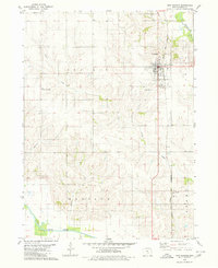
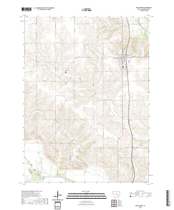
New Sharon anchors the northern portion of this Mahaska County landscape, where the grid of rural roads meets a terrain carved by the North Skunk River and South Skunk River. This 2022 survey documents a deeply rooted agricultural community, evident in the numerous small burial grounds that dot the countryside, such as Weatherwax Cem and Jackson Cem. The settlement of Lacey sits further south, positioned between the headwaters of Middle Cr and the larger river valleys. The intricate network of county roads, including Co HWY g23 and Co HWY g5t, connects these remote farmsteads and historic sites, reflecting a landscape that has maintained its rural character and spatial organization for generations.
Find a feature on this map
53 named features on this map. Tap any name to fly to it.
Don’t see what you’re looking for? This feature index may not catch every label — zoom into the map to look around manually.
Map Details
Editions of this 2022 New Sharon Map
This is the sole edition of this map. No revisions or reprints were ever made.