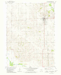
1980 Map of New Sharon
USGS Topo · Published 1980About this map
New Sharon serves as the primary hub of this Mahaska County landscape, where the Chicago and North Western railroad corridor cuts through the agricultural heartland. The town is flanked by historic burial grounds, including Highland Cem to the north and Friends Cem to the south, while the North Mahaska High Sch anchors the local community. To the west, Vander Waal Airport and a municipal Sewage Disposal site mark the transition from town to open prairie.
Find a feature on this map
18 named features on this map. Tap any name to fly to it.
Don’t see what you’re looking for? This feature index may not catch every label — zoom into the map to look around manually.
Map Details
Editions of this 1980 New Sharon Map
This is the sole edition of this map. No revisions or reprints were ever made.
Other maps of this area

1910 · Pella
USGS Topo · 1:62,500

1912 · Pella
USGS Topo · 1:62,500

1954 · Des Moines
USGS Topo · 1:250,000

1956 · Des Moines
USGS Topo · 1:250,000

1957 · Des Moines
USGS Topo · 1:250,000

1968 · University Park
USGS Topo · 1:24,000

1968 · Oskaloosa
USGS Topo · 1:24,000

1969 · Des Moines
USGS Topo · 1:250,000

1979 · Montezuma
USGS Topo · 1:24,000

1979 · Searsboro
USGS Topo · 1:24,000