
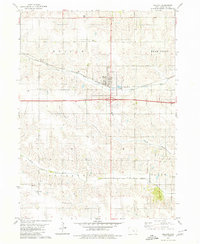
1979 Map of Searsboro
USGS Topo · Published 1980About this map
Searsboro serves as the central hub of this agricultural landscape in the late 1970s, situated at the intersection of the Chicago and North Western rail line and local roadways. The map captures a transition in transportation, showing both the active rail corridor and an Old RR Grade running toward Taintor. The terrain is defined by the winding course of the North Skunk River and a complex network of tributaries including English Creek, Sugar Creek, and multiple branches of Buck Creek. Local history is deeply etched into the township divisions of Washington, Sugar Creek, and Prairie, where family and community markers like Mill Grove Cem, Stewart Cem, and the West Liberty Ch remain as quiet landmarks. Small-scale industrial activity is evident through a scattered Quarry, Gravel Pit, and Sandpit, reflecting the rural economy of Poweshiek and Mahaska counties.
Find a feature on this map
28 named features on this map. Tap any name to fly to it.
Don’t see what you’re looking for? This feature index may not catch every label — zoom into the map to look around manually.
Map Details
Editions of this 1979 Searsboro Map
This is the sole edition of this map. No revisions or reprints were ever made.
Other maps of this area

1910 · Pella
USGS Topo · 1:62,500

1912 · Pella
USGS Topo · 1:62,500

1954 · Des Moines
USGS Topo · 1:250,000

1956 · Des Moines
USGS Topo · 1:250,000

1957 · Des Moines
USGS Topo · 1:250,000

1969 · Des Moines
USGS Topo · 1:250,000

1979 · Montezuma
USGS Topo · 1:24,000

1979 · Grinnell South
USGS Topo · 1:24,000
1979 · Malcom
USGS Topo · 1:24,000
1980 · Union Mills
USGS Topo · 1:24,000