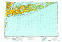
1957 Map of New York
USGS Topo · Published 1975About this map
Long Island serves as the focal point for this mid-century regional survey, illustrating the intensive post-war expansion across Nassau and Suffolk counties. The map documents the rapid suburbanization of planned communities like Levittown and industrial hubs such as Huntington Station, contrasted against the agricultural and maritime landscapes of the East End. Transportation arteries, including the Long Island RR and the Sunrise Highway, define the movement of people and commerce between the city boroughs of Brooklyn and Queens and the expanding outer reaches.
Find a feature on this map
292 named features on this map. Tap any name to fly to it.
Don’t see what you’re looking for? This feature index may not catch every label — zoom into the map to look around manually.
Map Details
Editions of this 1957 New York Map
This is the sole edition of this map. No revisions or reprints were ever made.
Other maps of this area

1888 · Barnegat
USGS Topo · 1:62,500

1888 · Asbury Park
USGS Topo · 1:62,500

1888 · Paterson
USGS Topo · 1:62,500

1888 · Sandy Hook
USGS Topo · 1:62,500

1889 · Brooklyn
USGS Topo · 1:62,500

1891 · Ramapo
USGS Topo · 1:62,500

1891 · Brooklyn
USGS Topo · 1:62,500

1891 · Harlem
USGS Topo · 1:62,500

1891 · Bridgeport
USGS Topo · 1:62,500

1892 · Stamford
USGS Topo · 1:62,500