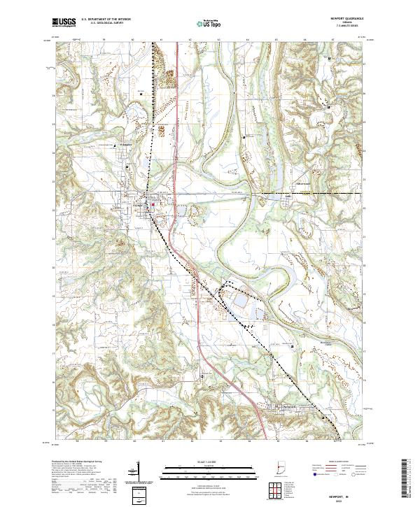
2022 Map of Newport
USGS Topo · Published 2022About this map
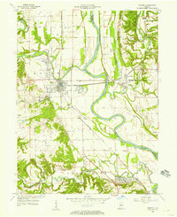
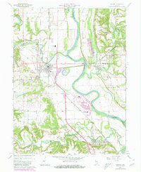
The Vermillion County Courthouse anchor the southern reaches of this landscape in Newport, where the Little Vermilion River winds toward its confluence with the larger Wabash River. This corridor of West Central Indiana is defined by the intersection of water and rail, with CSX Transportation lines bisecting the terrain near Cayuga and Eugene. The map documents a high density of rural burial grounds, including the Isle Cem, Groenendyke Cem, and Silver Island Cem, which offer significant value for genealogical research into the families of the Vermillion and Fountain county borderlands.
Find a feature on this map
63 named features on this map. Tap any name to fly to it.
Don’t see what you’re looking for? This feature index may not catch every label — zoom into the map to look around manually.
Map Details
Editions of this 2022 Newport Map
This is the sole edition of this map. No revisions or reprints were ever made.
Historical Maps of Parke County Through Time
3 maps found