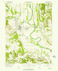
1955 Map of Newport
USGS Topo · Published 1957About this map
The Wabash River and its confluence with the Vermilion River anchor this mid-century landscape of western Indiana. The industrial character of the mid-1950s is evident in the presence of a Strip Mine and the active rail lines of the Chicago and Eastern Illinois and New York Central railroads. The town of Cayuga serves as a central hub, flanked by agricultural infrastructure like Grain Storage Bins and the Brickkiln.
Find a feature on this map
42 named features on this map. Tap any name to fly to it.
Don’t see what you’re looking for? This feature index may not catch every label — zoom into the map to look around manually.
Map Details
Editions of this 1955 Newport Map
This is the sole edition of this map. No revisions or reprints were ever made.
Other maps of this area

1899 · Danville
USGS Topo · 1:62,500

1900 · Danville
USGS Topo · 1:62,500

1947 · Ridge Farm
USGS Topo · 1:62,500

1950 · Danville SE
USGS Topo · 1:24,000

1951 · Danville SE
USGS Topo · 1:24,000

1953 · Danville
USGS Topo · 1:250,000

1953 · Indianapolis
USGS Topo · 1:250,000

1955 · Danville
USGS Topo · 1:250,000

1955 · Kingman
USGS Topo · 1:24,000

1955 · Humrick
USGS Topo · 1:24,000