
Loading...
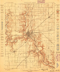
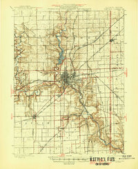
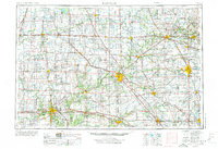
Loading map...1955 Map of Danville
USGS Topo · Published 1955About this map
Lafayette and the Wabash River valley anchor this mid-century portrait of the west-central Indiana and eastern Illinois borderlands. The landscape is a complex network of agriculture and industry, where the Pennsylvania RR, Wabash RR, and the Monon railroad converge on regional hubs like Kokomo, Danville, and Logansport. Academic and cultural centers are prominent, notably Purdue University in West Lafayette and Wabash College in Crawfordsville.
Find a feature on this map
390 named features on this map. Tap any name to fly to it.
Don’t see what you’re looking for? This feature index may not catch every label — zoom into the map to look around manually.
Map Details
Date Portrayed1955
Date Published1955
PublisherU.S. Geological Survey
Map TypeTopographic
Scale1:250,000
Physical Dimensions29.45 x 22.16 inches
Editions of this 1955 Danville Map
This is the sole edition of this map. No revisions or reprints were ever made.
Historical Maps of Carmel Through Time
7 maps found


Featured Locations
Source Details
SourceU.S. Geological Survey
CopyrightPublic Domain