
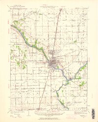
1922 Map of Kankakee
USGS Topo · Published 1959About this map
The Kankakee River and Iroquois River dominate this early 20th-century landscape, carving through a region defined by intense agricultural development and burgeoning industrial centers. The city of Kankakee serves as the primary hub, surrounded by satellite communities like Bourbonnais, Bradley, and West Kankakee. The map reveals a dense network of country schools, such as Altdorf School, Seedorf School, and Mellen School, which once anchored the rural townships before consolidation.
Find a feature on this map
96 named features on this map. Tap any name to fly to it.
Don’t see what you’re looking for? This feature index may not catch every label — zoom into the map to look around manually.
Map Details
Editions of this 1922 Kankakee Map
2 editions found
Other maps of this area

1892 · Wilmington
USGS Topo · 1:62,500

1918 · Wilmington
USGS Topo · 1:62,500

1922 · Momence
USGS Topo · 1:62,500

1923 · Herscher
USGS Topo · 1:62,500

1924 · Momence
USGS Topo · 1:62,500

1924 · Kankakee
USGS Topo · 1:62,500

1925 · Herscher
USGS Topo · 1:62,500

1935 · Watseka
USGS Topo · 1:48,000

1939 · Watseka
USGS Topo · 1:62,500

1944 · Piper City
USGS Topo · 1:48,000