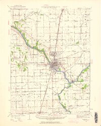
1922 Map of Kankakee
USGS Topo · Published 1961About this map
The Kankakee River and its confluence with the Iroquois River anchor this 1922 survey, illustrating a landscape defined by water and heavy rail transit. The city of Kankakee serves as the central hub, surrounded by early twentieth-century growth in Bradley and Bourbonnais. The presence of the East Illinois Hospital on the southern bank and the crossing of the Illinois Central and Chicago and Eastern Illinois railroads highlight the region's importance as a mid-century institutional and industrial corridor.
Find a feature on this map
100 named features on this map. Tap any name to fly to it.
Don’t see what you’re looking for? This feature index may not catch every label — zoom into the map to look around manually.
Map Details
Editions of this 1922 Kankakee Map
2 editions found
Other maps of this area

1892 · Wilmington
USGS Topo · 1:62,500

1918 · Wilmington
USGS Topo · 1:62,500

1922 · Momence
USGS Topo · 1:62,500

1922 · Kankakee
USGS Topo · 1:62,500

1923 · Herscher
USGS Topo · 1:62,500

1924 · Momence
USGS Topo · 1:62,500

1924 · Kankakee
USGS Topo · 1:62,500

1925 · Herscher
USGS Topo · 1:62,500

1935 · Watseka
USGS Topo · 1:48,000

1939 · Watseka
USGS Topo · 1:62,500