
1925 Map of Herscher
USGS Topo · Published 1925About this map
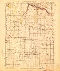
The Kankakee River sweeps across the northeastern corner of this 1920s landscape, providing a sharp contrast to the dense network of prairie rail lines and schools that defined central Illinois at the time. Five major railroads, including the Illinois Central RR and Chicago and Alton RR, crisscross the territory to serve agricultural hubs like Herscher and Buckingham. This era of rural education is exceptionally well-preserved here, with dozens of family-named schoolhouses such as Patchett School, Mosier School, and Dublin School spaced at regular intervals for local farm children. Near the settlement of Lehigh, the Lehigh Stone Co Quarry stands out as a significant industrial feature, while smaller sidings like Appel Siding and Dickeys Siding mark the critical points where local produce met the rail network. The map reveals the early 20th-century transition of the Grand Prairie into a highly organized grid of transport and township schools.
Find a feature on this map
67 named features on this map. Tap any name to fly to it.
Don’t see what you’re looking for? This feature index may not catch every label — zoom into the map to look around manually.
Map Details
Editions of this 1925 Herscher Map
2 editions found
Other maps of this area

1892 · Morris
USGS Topo · 1:62,500

1892 · Wilmington
USGS Topo · 1:62,500

1918 · Wilmington
USGS Topo · 1:62,500

1918 · Morris
USGS Topo · 1:62,500

1922 · Kankakee
USGS Topo · 1:62,500

1923 · Herscher
USGS Topo · 1:62,500

1924 · Kankakee
USGS Topo · 1:62,500

1944 · Piper City
USGS Topo · 1:48,000

1944 · Gilman
USGS Topo · 1:62,500

1946 · Gilman
USGS Topo · 1:62,500