
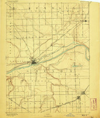
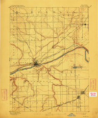
1892 Map of Morris
USGS Topo · Published 1892About this map
The Morris town site serves as the central hub of this late nineteenth-century landscape, positioned at the convergence of vital transport arteries including the Illinois and Michigan Canal and the Illinois River. This era captures the height of the region's industrial transition, where traditional water routes parallel the expanding steel ribbons of the Chicago Rock Island and Pacific Railway. To the south, the emergence of Coal City highlights the burgeoning extraction economy that defined Grundy County during this period.
Find a feature on this map
35 named features on this map. Tap any name to fly to it.
Don’t see what you’re looking for? This feature index may not catch every label — zoom into the map to look around manually.
Map Details
Editions of this 1892 Morris Map
3 editions found
Other maps of this area

1892 · Marseilles
USGS Topo · 1:62,500

1892 · Joliet
USGS Topo · 1:62,500

1892 · Wilmington
USGS Topo · 1:62,500

1916 · Marseilles
USGS Topo · 1:62,500

1918 · Wilmington
USGS Topo · 1:62,500

1918 · Morris
USGS Topo · 1:62,500

1923 · Joliet
USGS Topo · 1:62,500

1923 · Herscher
USGS Topo · 1:62,500

1925 · Yorkville
USGS Topo · 1:62,500

1925 · Herscher
USGS Topo · 1:62,500