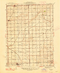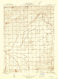
1944 Map of Piper City
USGS Topo · Published 1944About this map
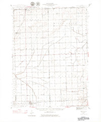
Piper City and the surrounding prairie of Ford County are defined by a dense network of rural one-room schoolhouses and intersecting rail lines in this mid-1940s survey. The Toledo Peoria and Western railroad runs east-west through the southern portion of the quadrangle, passing through Piper City and La Hogue, while the Illinois Central provides a north-south connection through Cabery and Kempton. The landscape is characterized by its agricultural organization, with family-named schools like Graham Sch, Ogilvie Sch, and Wadleigh Sch positioned every few miles to serve the farming community. Waterways such as the North Fork Vermilion River and Kelly Creek provide the primary natural drainage across these flatlands. Religious and civic life is anchored by landmarks like Milks Grove Ch and the Town Hall in Rogers, alongside established burial grounds including St Joseph Cem and Edgerville Cem.
Find a feature on this map
69 named features on this map. Tap any name to fly to it.
Don’t see what you’re looking for? This feature index may not catch every label — zoom into the map to look around manually.
Map Details
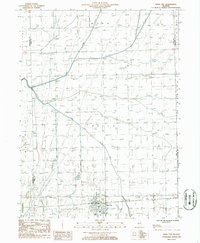
Editions of this 1944 Piper City Map
2 editions found
Historical Maps of Gilman Through Time
8 maps found