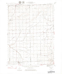
1944 Map of Piper City
USGS Topo · Published 1979About this map
Piper City and the surrounding prairie of Ford County are depicted here in a mid-century landscape defined by rural education and rail transport. The settlement pattern is anchored by small towns like Cabery and Kempton, connected by the Illinois Central and the Toledo Peoria and Western railroads. A remarkable density of country schoolhouses, such as Graham Sch, Dayton Sch, and Scott Sch, illustrates the decentralized nature of rural Illinois life before school consolidation became widespread. The terrain is largely level, drained by the Vermilion River and Kelly Creek, with subtle elevations like Sand Ridge providing contrast to the agricultural grid. Local history is further preserved through sites like St Joseph Cem and the small station at La Hogue, which served as vital points for the local farm economy during this era.
Find a feature on this map
67 named features on this map. Tap any name to fly to it.
Don’t see what you’re looking for? This feature index may not catch every label — zoom into the map to look around manually.
Map Details
Editions of this 1944 Piper City Map
2 editions found
Other maps of this area

1922 · Kankakee
USGS Topo · 1:62,500

1923 · Herscher
USGS Topo · 1:62,500

1924 · Kankakee
USGS Topo · 1:62,500

1925 · Herscher
USGS Topo · 1:62,500

1939 · Cissna Park
USGS Topo · 1:62,500

1944 · Piper City
USGS Topo · 1:48,000

1944 · Gilman
USGS Topo · 1:62,500

1946 · Gilman
USGS Topo · 1:62,500

1947 · Piper City
USGS Topo · 1:62,500

1947 · Sibley
USGS Topo · 1:62,500