
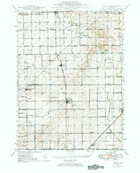
1947 Map of Sibley
USGS Topo · Published 1965About this map
The Wabash RR and Illinois Central RR intersect at Sibley, a prairie town defined by the waters of Lake Sibley and its surrounding agricultural landscape. This survey, compiled from 1940 aerial photography and 1947 field work under the direction of M. M. Leighton, documents an era of dense rural settlement where nearly every section supported its own neighborhood school. The distribution of sites like Happy Home Sch, Bee Hive Sch, and Pleasant View Sch illustrates the pre-consolidation school system in Livingston and Ford Counties. Drainage patterns are clearly marked along the Mackinaw River and South Fork Vermilion River, revealing how early infrastructure followed the natural watercourses. The map also records numerous country cemeteries and churches, such as Mt Hope Cem and St Johns Ch, which remain vital touchstones for genealogists tracing family roots in this corner of the Illinois plains.
Find a feature on this map
77 named features on this map. Tap any name to fly to it.
Don’t see what you’re looking for? This feature index may not catch every label — zoom into the map to look around manually.
Map Details
Editions of this 1947 Sibley Map
2 editions found
Other maps of this area

1924 · Paxton
USGS Topo · 1:62,500

1927 · Paxton
USGS Topo · 1:62,500

1928 · Gibson City
USGS Topo · 1:62,500

1935 · Pontiac
USGS Topo · 1:62,500

1939 · Pontiac
USGS Topo · 1:62,500

1944 · Piper City
USGS Topo · 1:48,000

1947 · Piper City
USGS Topo · 1:62,500

1947 · Cullom
USGS Topo · 1:62,500

1948 · Buckley
USGS Topo · 1:62,500

1949 · Buckley
USGS Topo · 1:62,500