
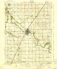
1939 Map of Pontiac
USGS Topo · Published 1939About this map
The Vermillion River carves a winding path through the center of Livingston County, anchoring the regional hub of Pontiac. This late-1930s landscape is defined by its extensive rural infrastructure, where nearly every section corner supports a local institution like the Wolf Creek Sch or Jordon Sch. Notable for its social and civic institutions, the map details the grounds of the State Retormatory and the County Farm just outside the main settlement.
Find a feature on this map
104 named features on this map. Tap any name to fly to it.
Don’t see what you’re looking for? This feature index may not catch every label — zoom into the map to look around manually.
Map Details
Editions of this 1939 Pontiac Map
2 editions found
Other maps of this area

1925 · Streator
USGS Topo · 1:62,500

1926 · Normal
USGS Topo · 1:62,500

1927 · Streator
USGS Topo · 1:62,500

1930 · Normal
USGS Topo · 1:62,500

1935 · Pontiac
USGS Topo · 1:62,500

1947 · Sibley
USGS Topo · 1:62,500

1947 · Cullom
USGS Topo · 1:62,500

1948 · Dwight
USGS Topo · 1:62,500

1949 · Cullom
USGS Topo · 1:62,500

1949 · Sibley
USGS Topo · 1:62,500