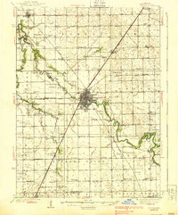
1939 Map of Pontiac
USGS Topo · Published 1939About this map
The Pontiac city center and its surrounding prairie townships are defined by a complex intersection of rail and water in the late 1930s. The Vermillion River meanders sharply through the landscape, flanked by the State Reformatory and the Country Club. This era shows a dense network of one-room schoolhouses like Enterprise Sch, Champion Sch, and Georgetown Sch that served the rural townships of Esmen, Owego, and Eppards Point. The transit layout is particularly striking, with the Alton, Wabash, and Illinois Central railroads all converging toward the county seat. For local historians, the map preserves the exact locations of smaller landmarks such as the County Farm and a variety of family-named burial grounds, including the curiously named Fatty Cem and Payne Cem.
Find a feature on this map
89 named features on this map. Tap any name to fly to it.
Don’t see what you’re looking for? This feature index may not catch every label — zoom into the map to look around manually.
Map Details
Editions of this 1939 Pontiac Map
2 editions found
Other maps of this area

1925 · Streator
USGS Topo · 1:62,500

1926 · Normal
USGS Topo · 1:62,500

1927 · Streator
USGS Topo · 1:62,500

1930 · Normal
USGS Topo · 1:62,500

1935 · Pontiac
USGS Topo · 1:62,500

1939 · Pontiac
USGS Topo · 1:62,500

1947 · Sibley
USGS Topo · 1:62,500

1947 · Cullom
USGS Topo · 1:62,500

1948 · Dwight
USGS Topo · 1:62,500

1949 · Cullom
USGS Topo · 1:62,500