
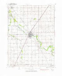
1935 Map of Pontiac
USGS Topo · Published 1968About this map
The Vermillion River meanders through the heart of this Livingston County landscape, defining the layout of Pontiac and its rural surroundings during the mid-1930s. This survey reveals a high density of one-room schoolhouses, such as Lammatch Sch and Champion Sch, which served the agricultural townships of Eppards Point and Rooks Creek before the era of modern school consolidation. The presence of the State Reformatory and the County Farm near the city center provides a look at the social infrastructure of the time.
Find a feature on this map
90 named features on this map. Tap any name to fly to it.
Don’t see what you’re looking for? This feature index may not catch every label — zoom into the map to look around manually.
Map Details
Editions of this 1935 Pontiac Map
2 editions found
Other maps of this area

1925 · Streator
USGS Topo · 1:62,500

1926 · Normal
USGS Topo · 1:62,500

1927 · Streator
USGS Topo · 1:62,500

1930 · Normal
USGS Topo · 1:62,500

1939 · Pontiac
USGS Topo · 1:62,500

1947 · Sibley
USGS Topo · 1:62,500

1947 · Cullom
USGS Topo · 1:62,500

1948 · Dwight
USGS Topo · 1:62,500

1949 · Cullom
USGS Topo · 1:62,500

1949 · Sibley
USGS Topo · 1:62,500