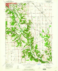
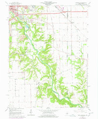
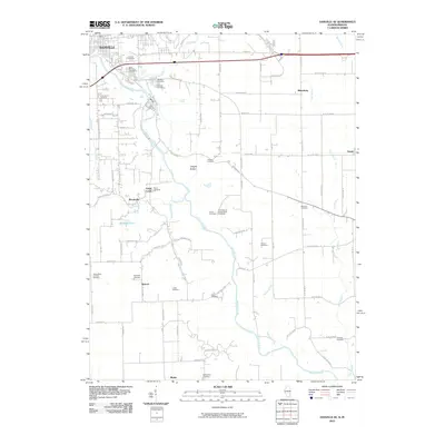
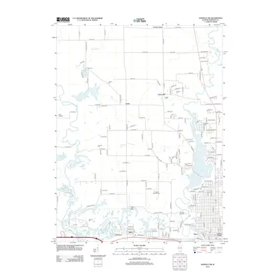
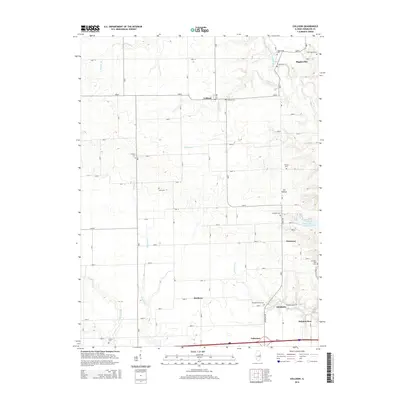
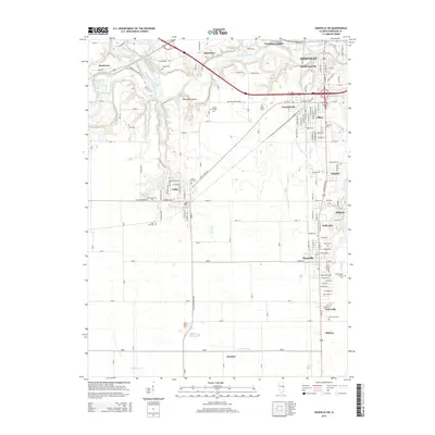
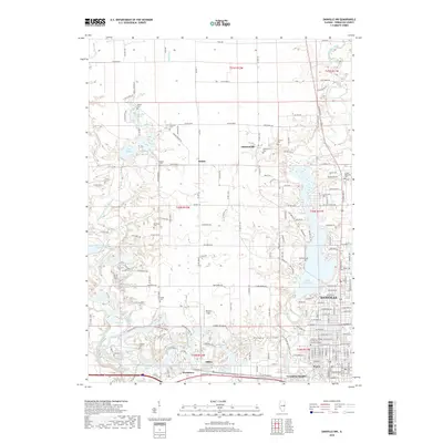
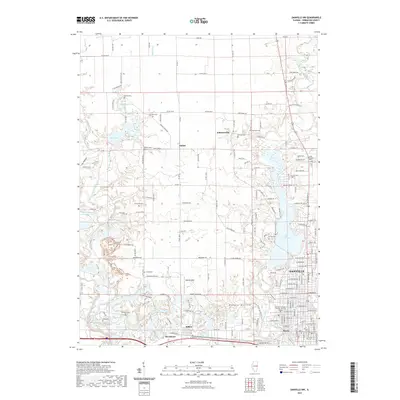
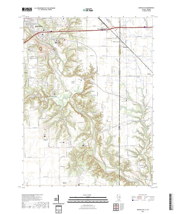
1950 Map of Danville SE
USGS Topo · Published 1960About this map
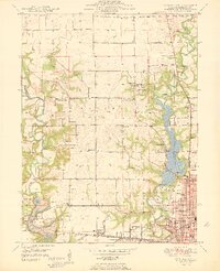
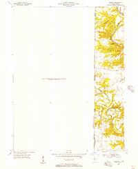
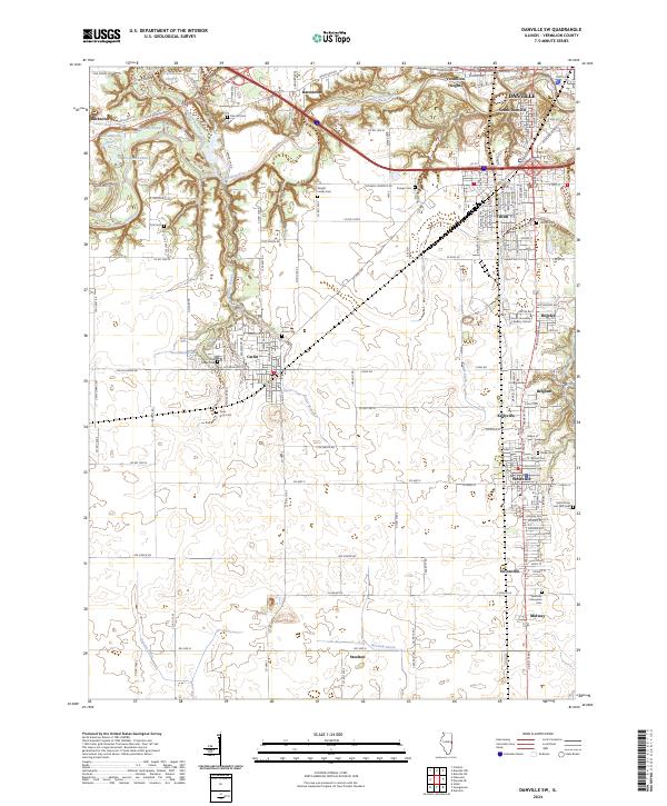
The Vermilion River carves a deep, forested valley through this landscape, separating the industrial and institutional expansion of south Danville from the rural borderlands of Illinois and Indiana. The mid-century city is anchored by large-scale facilities including the Veterans Hospital, St Elizabeth Hospital, and the Municipal Airport. To the south, the terrain becomes increasingly complex as the Langley Bottom gives way to a network of creeks like Grape Creek and Hawbuck Creek. Evidence of early resource extraction is visible through scattered labels for a Strip Mine and an Inactive Mine. This era shows a dense network of rural infrastructure, from parochial schools like St Patrick Sch to country institutions such as Union Corner Sch and Morey Chapel, many of which served the small communities of Rileysburg and Gessie along the Chicago and Eastern Illinois railroad line.
Find a feature on this map
53 named features on this map. Tap any name to fly to it.
Don’t see what you’re looking for? This feature index may not catch every label — zoom into the map to look around manually.
Map Details
Editions of this 1950 Danville SE Map
This is the sole edition of this map. No revisions or reprints were ever made.
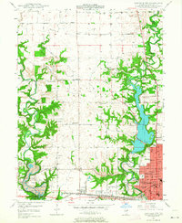
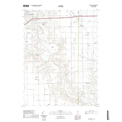
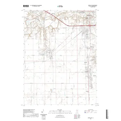
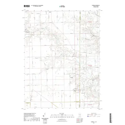
Historical Maps of Danville Through Time
48 maps found
1948 Danville NW
Vermilion County, IL
1949 Danville SW
Vermilion County, IL
1950 Danville NE
Vermilion County, IL
1950 Danville NW
Vermilion County, IL
1950 Danville SE
Vermilion County, IL
1950 Danville SW
Vermilion County, IL
1951 Danville NE
Vermilion County, IL
1951 Danville SE
Vermilion County, IL
1955 Humrick
Vermilion County, IL
1965 Humrick
Vermilion County, IL
1966 Danville NE
Vermilion County, IL
1966 Danville NW
Vermilion County, IL
1966 Danville SE
Vermilion County, IL
1966 Danville SW
Vermilion County, IL
1968 Collison
Vermilion County, IL
2010 Danville NE
Vermilion County, IL
2010 Danville SE
Vermilion County, IL
2010 Humrick
Vermilion County, IL
2012 Collison
Vermilion County, IL
2012 Danville NE
Vermilion County, IL
2012 Danville NW
Vermilion County, IL
2012 Danville SE
Vermilion County, IL
2012 Danville SW
Vermilion County, IL
2012 Humrick
Vermilion County, IL
2015 Collison
Vermilion County, IL
2015 Danville NE
Vermilion County, IL
2015 Danville NW
Vermilion County, IL
2015 Danville SE
Vermilion County, IL
2015 Danville SW
Vermilion County, IL
2015 Humrick
Vermilion County, IL
2018 Collison
Vermilion County, IL
2018 Danville NE
Vermilion County, IL
2018 Danville NW
Vermilion County, IL
2018 Danville SE
Vermilion County, IL

2018 Danville SW
Vermilion County, IL

2018 Humrick
Vermilion County, IL
2021 Collison
Vermilion County, IL
2021 Danville NE
Vermilion County, IL
2021 Danville NW
Vermilion County, IL
2021 Danville SE
Vermilion County, IL
2021 Danville SW
Vermilion County, IL
2021 Humrick
Vermilion County, IL
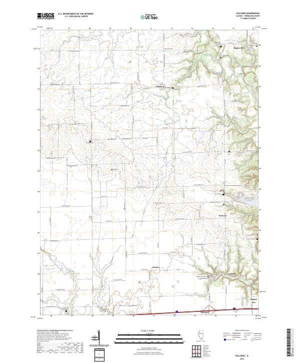
2024 Collison
Vermilion County, IL
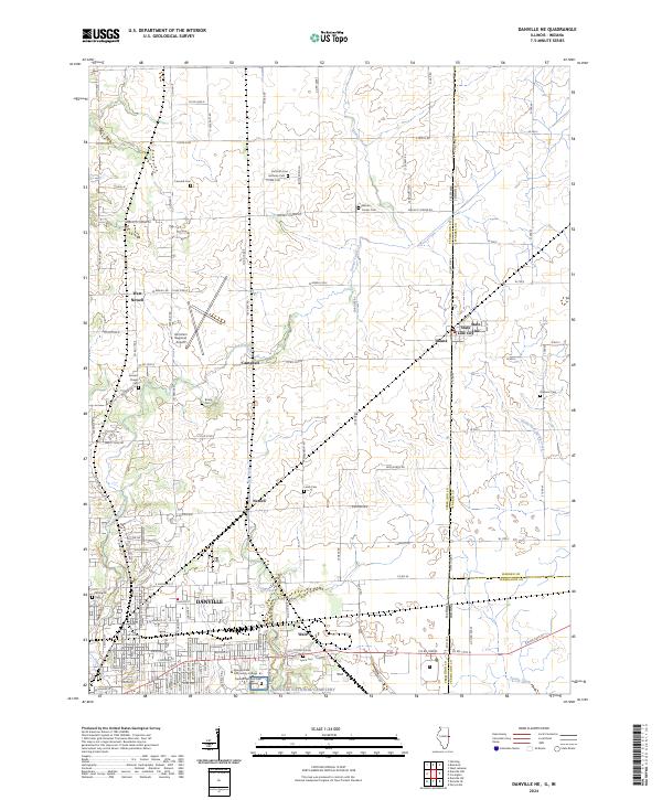
2024 Danville NE
Vermilion County, IL
2024 Danville NW
Vermilion County, IL
2024 Danville SE
Vermilion County, IL
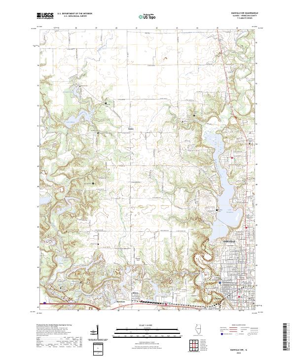
2024 Danville SW
Vermilion County, IL
2024 Humrick
Vermilion County, IL