
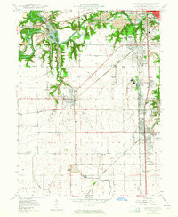
1949 Map of Danville SW
USGS Topo · Published 1960About this map
The Vermilion River carves a deep path through the north, where Kickapoo State Park borders active and former extraction sites, including a massive Strip Mine. This 1949 survey illustrates an era of industrial and rail dominance southwest of Danville, where the Illinois Terminal, Wabash, and New York Central railroads converge to serve the region's coal operations.
Find a feature on this map
51 named features on this map. Tap any name to fly to it.
Don’t see what you’re looking for? This feature index may not catch every label — zoom into the map to look around manually.
Map Details
Editions of this 1949 Danville SW Map
2 editions found
Other maps of this area

1899 · Danville
USGS Topo · 1:62,500

1900 · Danville
USGS Topo · 1:62,500

1931 · Fithian
USGS Topo · 1:48,000

1943 · Fithian
USGS Topo · 1:62,500

1947 · Ridge Farm
USGS Topo · 1:62,500

1948 · Danville NW
USGS Topo · 1:24,000

1950 · Danville SW
USGS Topo · 1:24,000

1950 · Danville NW
USGS Topo · 1:24,000

1950 · Danville SE
USGS Topo · 1:24,000

1950 · Danville NE
USGS Topo · 1:24,000