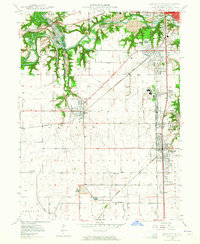
1949 Map of Danville SW
USGS Topo · Published 1965About this map
Industrial extraction and small-town growth define this mid-century landscape in Vermilion County. The northern reaches are heavily marked by extensive Strip Mine operations along the Vermilion River, while the eastern corridor shows a dense concentration of settlement and industry following the rail lines. Communities like Westville, Belgium, and South Danville appear during a peak era of rail transport, served by a network including the Wabash and Illinois Central.
Find a feature on this map
45 named features on this map. Tap any name to fly to it.
Don’t see what you’re looking for? This feature index may not catch every label — zoom into the map to look around manually.
Map Details
Editions of this 1949 Danville SW Map
2 editions found
Other maps of this area

1899 · Danville
USGS Topo · 1:62,500

1900 · Danville
USGS Topo · 1:62,500

1931 · Fithian
USGS Topo · 1:48,000

1943 · Fithian
USGS Topo · 1:62,500

1947 · Ridge Farm
USGS Topo · 1:62,500

1948 · Danville NW
USGS Topo · 1:24,000

1949 · Danville SW
USGS Topo · 1:24,000

1950 · Danville SW
USGS Topo · 1:24,000

1950 · Danville NW
USGS Topo · 1:24,000

1950 · Danville SE
USGS Topo · 1:24,000