Old Maps of Danville, Illinois
Explore 41 old maps of Danville, spanning from 1899 to today. These high-resolution historic maps reveal how streets, neighborhoods, landmarks, and natural features evolved over time — perfect for genealogy, metal detecting, research, and local history exploration.
What you can do with these maps:
- See how Danville changed over time: Compare historical maps to modern-day views to trace roads, homesites, rail lines & more.
- View detailed metadata: Each map includes creators, publishers, year, scale, and archive source.
- Overlay maps with satellite & LiDAR: Visualize the past alongside modern tools to explore terrain & human change.
- Trusted historical sources: Maps sourced from the USGS, Library of Congress, and other archives.
- Access maps your way: View online, download high-res files, or order prints for personal or research use.
Start exploring old maps of Danville to uncover forgotten places, hidden landmarks, and the deep history beneath your feet.
Danville, IL maps
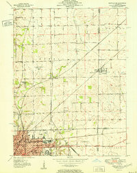
(41)- 1899 Map of Danville
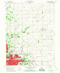
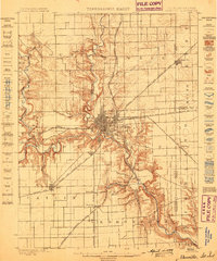 1899 Danville1899 Print · USGSDanville and the surrounding Vermilion County townships thrived at a massive rail intersection before the turn of the century. Genealogists and historians can trace the early layouts of Batestown, Catlin, and Rileysburg along the Vermilion River.
 - 1900 Map of Danville
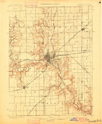 1900 Danville1900 Print · USGSVermilion County at the turn of the century is a bustling rail center defined by the junction of major freight lines and the Vermilion River. Genealogists can trace family footprints in early settlements like Westville, Batestown, and the border community of State Line.7 unique versions available
 - 1948 Map of Danville NW, 1964 Print
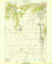
 1948 Danville NW1964 Print · USGSVermilion County transitions from industrial rail hubs to rural township life shortly after the war. Researchers can trace the development of Danville neighborhoods and find family-named landmarks like Johnsonville, Bethel Ch, and the Spring Hill Cem.
 - 1949 Map of Danville SW, 1960 Print
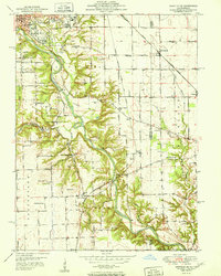
 1949 Danville SW1960 Print · USGSVermilion County's coal and rail landscape is captured here in the late 1940s, showing the tight-knit mining towns southwest of Danville. Genealogists and local historians can trace family roots through sites like the Lithuanian Cem, D Day Mine, and several rural schoolhouses like Shiloh Sch.2 unique versions available
 - 1950 Map of Danville SW
 1950 Danville SW1950 Print · USGSThe Vermilion County coalfields and rail hubs are captured here at mid-century. Researchers can trace family history through sites like Sts Peter and Paul Cem or the industrial landscape of the D Day Mine and Wabash Railroad.
 - 1950 Map of Danville NW
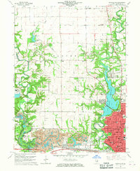
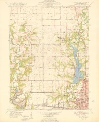 1950 Danville NW1950 Print · USGSThe northwestern outskirts of Danville and the Vermilion River valley are captured here in the mid-century, as industrial mining and new recreational parks met. Genealogists and historians can trace the New York Central rail line past Eureka Sch, Hillery, and the grounds of Kickapoo State Park.
 - 1950 Map of Danville SE, 1960 Print
 1950 Danville SE1960 Print · USGSThe Illinois-Indiana borderlands at mid-century reveal a landscape defined by the winding Vermilion River and the expansion of southern Danville. Genealogists and local researchers can trace a dense network of family landmarks and rural institutions, from Sandhill Memorial Park to the Willow Springs Sch and Morey Chapel.
 - 1950 Map of Danville NE, 1962 Print
 1950 Danville NE1962 Print · USGSDanville and the surrounding Illinois-Indiana borderlands are captured here at a mid-century peak of rail and industry. Researchers can trace family roots through numerous rural institutions like Grange Hall Sch, Spring Hill Cemetery, and the Hopewell Ch.
 - 1951 Map of Danville NE
 1951 Danville NE1951 Print · USGSThe Illinois and Indiana state line comes alive in the early 1950s as Danville's rail-and-road network reaches toward the border. Researchers can trace family history at Oaklawn Cem and Bryley Cem or locate vanished rural schoolhouses like Lamb Sch and Ash Corner Sch.
 - 1951 Map of Danville SE
 1951 Danville SE1951 Print · USGSVermilion County at mid-century reveals a landscape balancing heavy industry with deep-rooted rural communities. Genealogists and historians can trace family landmarks like Morey Chapel, the Langley Cemetery, and numerous country schools from Grape Creek Sch to Jenkins Sch.
 - 1953 Map of Danville, 1965 Print
 1953 Danville1965 Print · USGSIndiana and Illinois crossroads come to life in this mid-century survey as the interstate era begins to reshape the river-and-rail landscape. Genealogists and collectors can trace the historic paths of the Nickel Plate railroad or locate smaller communities like Veedersburg, Goodland, and Bismarck.3 unique versions available
 - 1955 Map of Danville
 1955 Danville1955 Print · USGSThe Indiana-Illinois borderlands during the mid-fifties reveal a landscape of thriving rail hubs and university towns. Researchers can trace the legacy of Purdue University, the Tippecanoe Battlefield, and the path of the Pennsylvania RR.
 - 1956 Map of Danville
 1956 Danville1956 Print · USGSMid-century Indiana and Illinois are captured here as the river-and-rail economy evolved into the modern highway era. Researchers can trace ancestral roots and old transport lines through Logansport, Battle Ground, and the dams at Lake Shafer.
 - 1966 Map of Danville SE, 1967 Print
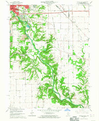 1966 Danville SE1967 Print · USGSThe bluffs of the Vermilion River and the expanding south side of Danville are captured here in the mid-sixties. Genealogists and historians can trace numerous rural burial sites like Atherton Cem or locate the University of Illinois Radio Telescope.2 unique versions available
 - 1966 Map of Danville SW, 1967 Print
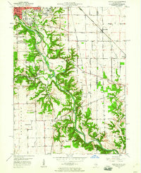
 1966 Danville SW1967 Print · USGSVermilion County in the mid-sixties reveals a landscape shaped by coal extraction and heavy rail. Genealogists and historians can trace family plots at Oak Ridge Cemetery or study the industrial layout of the Deep Valley Mine and V-Day Mine.2 unique versions available
 - 1966 Map of Danville NE, 1967 Print
 1966 Danville NE1967 Print · USGSThe Illinois-Indiana borderlands come to life in the mid-1960s as Danville expands toward the state line. Genealogists and historians can trace rail-side settlements like Newell and find several family-named landmarks including Leonard Cem and Bryley Cem.2 unique versions available
 - 1966 Map of Danville NW, 1967 Print
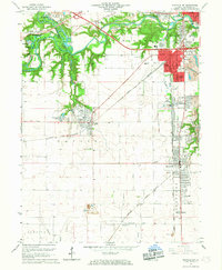
 1966 Danville NW1967 Print · USGSThe northern edge of Danville in the mid-sixties reveals a landscape shaped by coal mining and river-fed recreation. Genealogists and historians can trace family burial sites like Snyder Cem and Thurman Cem or the industrial footprint of the Harmarttan Strip Mine.2 unique versions available
 - 1984 Map of Danville, 1985 Print
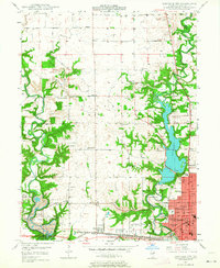
 1984 Danville1985 Print · USGSEastern Illinois and western Indiana meet here in the mid-1980s, centered on the river forks and rail lines surrounding the industrial hub of Danville. Researchers can trace old transport routes and rural landmarks like Rossville Junction, Hope Ch, and the Univ of Ill Radio Telescope.
 - 1987 Map of Danville, 1994 Print
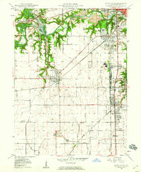
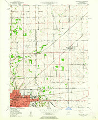
 1987 Danville1994 Print · USGSThe Illinois-Indiana borderlands thrived in the 1980s as a crossroads of rail commerce and river-fed agriculture. Genealogists and historians can trace the foundations of Danville and Covington while locating landmarks like Spring Hill Cemetery or the Vermilion County Courthouse.
 - 2010 Map of Danville NE, 2010 Print
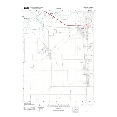
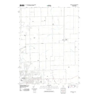 2010 Danville NE2010 Print · USGSCovers Danville, including Illiana, State Line, and other nearby areas
 - 2010 Map of Danville SE, 2010 Print
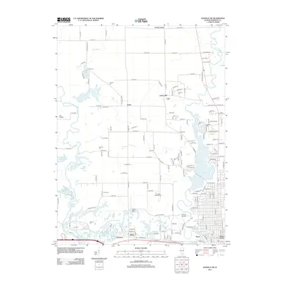
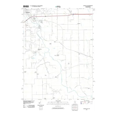 2010 Danville SE2010 Print · USGSCovers Danville, including Tilton, Grape Creek, and other nearby areas
 - 2012 Map of Danville SW, 2012 Print
 2012 Danville SW2012 Print · USGSCovers Danville, including Westville, Tilton, and other nearby areas
 - 2012 Map of Danville NW, 2012 Print
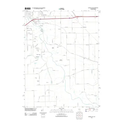
 2012 Danville NW2012 Print · USGSCovers Danville, including Hartshorn, Johnsonville, and other nearby areas
 - 2012 Map of Danville SE, 2012 Print
 2012 Danville SE2012 Print · USGSCovers Danville, including Tilton, Grape Creek, and other nearby areas
 - 2012 Map of Danville NE, 2012 Print
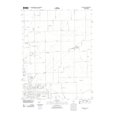 2012 Danville NE2012 Print · USGSCovers Danville, including Illiana, State Line, and other nearby areas
Showing maps 1-25 of 41
Top cities near Danville
- Georgetown historical maps
- Westville historical maps
- Tilton historical maps
- Covington historical maps
- Catlin historical maps
- Eugene historical maps
See more
Top neighborhoods of Danville
Frequently asked questions
- What are the different types of historical maps available for Danville?
- What is the oldest map of Danville?
- Where can I purchase historical maps of Danville for my home or office?
- Where can I download high-res historical maps of Danville?
- Are there historical topographic maps available for Danville?
- Is there historical aerial imagery available for Danville?
- Where are historical maps of Danville sourced from?