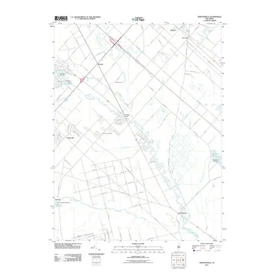
2011 Map of Newtonville
USGS Topo · Published 2011About this map
Great Egg Harbor River snakes through the heart of this South Jersey landscape, anchoring a network of streams and riparian corridors including the Hospitality Branch and Indian Branch. The 2011 topography highlights a transition from the consolidated residential grids of Newtonville and Folsom to the lower-density outlying settlements of Penny Pot and Weymouth. Small-scale water management is evident throughout the region, marked by various impoundments such as Cushman Lake, Lake Albert, and Makepeace Lake, each with its own identified dam.
Find a feature on this map
108 named features on this map. Tap any name to fly to it.
Don’t see what you’re looking for? This feature index may not catch every label — zoom into the map to look around manually.
Map Details
Editions of this 2011 Newtonville Map
This is the sole edition of this map. No revisions or reprints were ever made.
Other maps of this area

1890 · Great Egg Harbor
USGS Topo · 1:62,500

1890 · Hammonton
USGS Topo · 1:62,500

1890 · Tuckahoe
USGS Topo · 1:62,500

1890 · Mullica
USGS Topo · 1:62,500

1893 · Great Egg Harbor
USGS Topo · 1:62,500

1893 · Tuckahoe
USGS Topo · 1:62,500

1894 · Hammonton
USGS Topo · 1:62,500

1894 · Mullica
USGS Topo · 1:62,500

1898 · Mullica
USGS Topo · 1:62,500

1898 · Hammonton
USGS Topo · 1:62,500