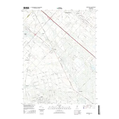
2016 Map of Newtonville
USGS Topo · Published 2016About this map
Newtonville and the uniquely named Gigantic City anchor this landscape within the New Jersey Pine Barrens, where a complex network of waterways defines the terrain. The Great Egg Harbor River flows through the southern reaches, fed by the Hospitality Branch, Penny Pot Stream, and Indian Br. These waters historically supported local industry, evidenced by the Pancoast Mill Pond near the settlement of Pancoast. Transportation corridors are a defining characteristic, with the modern Atlantic City Expressway and Black Horse Pike cutting through the forested blocks. The map reveals a mix of dense residential grids and remote cedar swamps, particularly around Makepeace Lake and Makepeace Stream. Genealogists may find interest in the Newtonville Cem, while local historians can trace the paths of the Conrail line and the White Horse Pike as they pass through Da Costa and Barnard.
Find a feature on this map
141 named features on this map. Tap any name to fly to it.
Don’t see what you’re looking for? This feature index may not catch every label — zoom into the map to look around manually.
Map Details
Editions of this 2016 Newtonville Map
This is the sole edition of this map. No revisions or reprints were ever made.
Other maps of this area

1890 · Great Egg Harbor
USGS Topo · 1:62,500

1890 · Hammonton
USGS Topo · 1:62,500

1890 · Tuckahoe
USGS Topo · 1:62,500

1890 · Mullica
USGS Topo · 1:62,500

1893 · Great Egg Harbor
USGS Topo · 1:62,500

1893 · Tuckahoe
USGS Topo · 1:62,500

1894 · Hammonton
USGS Topo · 1:62,500

1894 · Mullica
USGS Topo · 1:62,500

1898 · Mullica
USGS Topo · 1:62,500

1898 · Hammonton
USGS Topo · 1:62,500