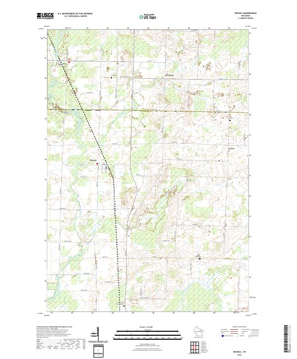
2022 Map of Nichols
USGS Topo · Published 2022About this map
Nichols serves as the central hub of this agricultural and wetland landscape near the border of Shawano and Outagamie counties. The Shioc River meanders through the western portion of the quadrangle, defining the low-lying terrain that characteristically alternates between cultivated fields and extensive marshy pockets. This area, largely defined by the Public Land Survey System grid, shows a dense network of country roads such as Soo Line Rd and Old Hwy 47 that connect small crossroads settlements like Briarton and Cicero. Local history and genealogy are anchored by several established burial grounds, including Immanuel Lutheran Cem and the North Cicero Cem. The hydrology is dominated by small tributaries like Toad Cr and Black Cr, which drain the flat, fertile plains surrounding these rural Wisconsin communities.
Find a feature on this map
63 named features on this map. Tap any name to fly to it.
Don’t see what you’re looking for? This feature index may not catch every label — zoom into the map to look around manually.
Map Details
Editions of this 2022 Nichols Map
This is the sole edition of this map. No revisions or reprints were ever made.
Other maps of this area

1955 · Embarrass
USGS Topo · 1:48,000

1955 · Appleton
USGS Topo · 1:62,500

1955 · Seymour
USGS Topo · 1:62,500

1955 · Green Bay
USGS Topo · 1:250,000

1956 · New London
USGS Topo · 1:48,000

1969 · Leeman
USGS Topo · 1:24,000

1969 · Lunds
USGS Topo · 1:24,000
1969 · Shiocton
USGS Topo · 1:24,000

1974 · Seymour
USGS Topo · 1:24,000

1974 · Zachow
USGS Topo · 1:24,000