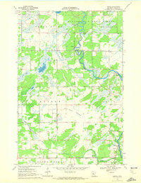
1969 Map of Nimrod
USGS Topo · Published 1972About this map
The Crow Wing River and Shell River converge in this remote landscape, defining the character of north-central Minnesota at the end of the 1960s. Much of the northern terrain is managed as the Huntersville State Forest, where the river's meandering path creates distinctive features like the Kossila Oxbow and several notable river crossings at Butterfield Rapids and Watkins Rapids. For genealogists and local historians, the map identifies the Finnish Cem and the small settlement of Nimrod near the riverbanks. The land between the waterways is a mixture of marsh and open space, exemplified by the vast Wire Grass Meadow. This survey provides a clear look at the township structure across Meadow, Horton, and North Germany, capturing the rural infrastructure of Wadena County before modern development altered these traditional boundaries.
Find a feature on this map
26 named features on this map. Tap any name to fly to it.
Don’t see what you’re looking for? This feature index may not catch every label — zoom into the map to look around manually.
Map Details
Editions of this 1969 Nimrod Map
This is the sole edition of this map. No revisions or reprints were ever made.
Other maps of this area

1953 · Brainerd
USGS Topo · 1:250,000

1957 · Brainerd
USGS Topo · 1:250,000

1958 · Brainerd
USGS Topo · 1:250,000

1965 · Brainerd
USGS Topo · 1:250,000

1969 · Menahga
USGS Topo · 1:24,000

1969 · Sebeka
USGS Topo · 1:24,000
1969 · Blue Grass
USGS Topo · 1:24,000
1969 · Nimrod SW
USGS Topo · 1:24,000

1969 · Burgen Lake
USGS Topo · 1:24,000
1969 · Oylen
USGS Topo · 1:24,000