2022 Map of Nolensville
USGS Topo · Published 2022About this map
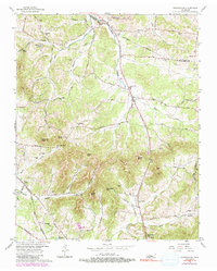
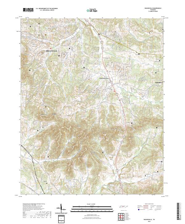
Nolensville and the southern edge of Brentwood define this landscape, where the rapidly developing suburbs of Middle Tennessee meet the older agricultural topography of the Central Basin. The terrain is marked by prominent high points such as McMahan Knob, Potato Hill, and Daddy Knob, with numerous drainages like Mill Creek and Arrington Cr cutting through the ridges. For genealogists and local historians, this map is particularly dense with family burying grounds, including the Street Cem, Halley Rash Cem, and Hopewell AME Cem. The transition from rural homesteads to residential developments is evident in the layout of Lake Colonial Estates and the networks branching off Nolensville Pike. Historic transportation corridors like Wilson Pike and Edmondson Pike trace the winding paths between the hills, connecting the dispersed settlements and landmarks that define the region's heritage.
Find a feature on this map
64 named features on this map. Tap any name to fly to it.
Don’t see what you’re looking for? This feature index may not catch every label — zoom into the map to look around manually.
Map Details
Editions of this 2022 Nolensville Map
This is the sole edition of this map. No revisions or reprints were ever made.