2021 Map of Norborne
USGS Topo · Published 2021About this map
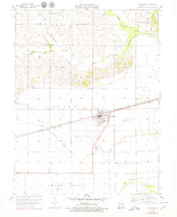
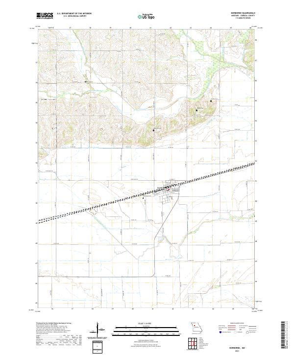
Norborne serves as the focal point of this Carroll County landscape, oriented around a grid that includes E Santa Fe St and E Park St. The surrounding terrain is defined by a complex drainage system essential to the local agricultural economy, featuring the Norborne Drainage Ditch and natural waterways like Wakenda Cr and its western fork. The presence of several distinct burial sites, including Fairhaven Cem on the edge of town and the more remote Lutheran Cem and German Cem to the north, suggests a history of localized rural congregations and established family plots. These features, along with Booker Slough and Moss Cr, illustrate a low-lying region where water management and traditional settlement patterns have long dictated the placement of roads and homesteads.
Find a feature on this map
69 named features on this map. Tap any name to fly to it.
Don’t see what you’re looking for? This feature index may not catch every label — zoom into the map to look around manually.
Map Details
Editions of this 2021 Norborne Map
This is the sole edition of this map. No revisions or reprints were ever made.