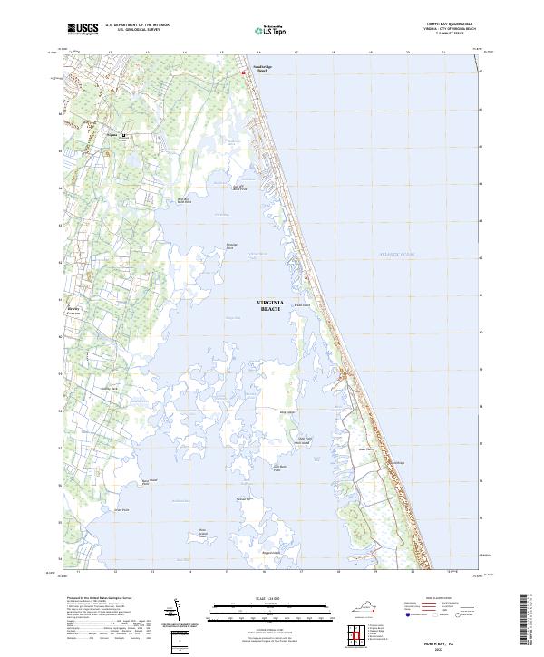
2022 Map of North Bay
USGS Topo · Published 2022About this map
Sandbridge Beach defines the narrow barrier coastline where the Atlantic Ocean meets a complex network of coastal bays and marshes. This environment is characterized by the vast expanse of North Bay, Shipps Bay, and Back Bay, which are separated from the ocean by a thin strip of land featuring Sand Ridge and the Wash Flats. The intricate shoreline is marked by numerous landforms including Charity Neck, Porpoise Point, and Heaven Point, illustrating the delicate balance between the land and the rising tide.
Find a feature on this map
39 named features on this map. Tap any name to fly to it.
Don’t see what you’re looking for? This feature index may not catch every label — zoom into the map to look around manually.
Map Details
Editions of this 2022 North Bay Map
This is the sole edition of this map. No revisions or reprints were ever made.
Other maps of this area

1893 · Virginia Beach
USGS Topo · 1:125,000

1907 · Norfolk
USGS Topo · 1:125,000

1916 · Back Bay
USGS Topo · 1:62,500

1918 · Cape Henry
USGS Topo · 1:62,500

1919 · Cape Henry
USGS Topo · 1:62,500

1939 · Moyock
USGS Topo · 1:62,500

1943 · Back Bay
USGS Topo · 1:62,500

1946 · Moyock
USGS Topo · 1:62,500

1946 · Eastville
USGS Topo · 1:250,000

1946 · Currituck Sound
USGS Topo · 1:250,000