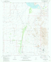
1981 Map of North Komelik
USGS Topo · Published 1981About this map
Mining operations and desert water management define this landscape within the Papago Indian Reservation during the early 1980s. The settlement at North Komelik sits at the southern edge of the Santa Rosa Valley, a broad expanse drained by the Santa Rosa Wash and Kohatk Wash. Industrial activity is concentrated on the eastern slopes of Slate Mountain, where a dense network of prospects and named mines such as the Lake Shore Mine, Old Mammon Mine, and Jackrabbit Mine suggests a long history of mineral exploration.
Find a feature on this map
35 named features on this map. Tap any name to fly to it.
Don’t see what you’re looking for? This feature index may not catch every label — zoom into the map to look around manually.
Map Details
Editions of this 1981 North Komelik Map
This is the sole edition of this map. No revisions or reprints were ever made.
Other maps of this area

1934 · Silver Bell
USGS Topo · 1:125,000

1941 · Vekol Mountains
USGS Topo · 1:62,500

1942 · Silver Reef Mountains
USGS Topo · 1:62,500

1942 · Vekol Mountains
USGS Topo · 1:62,500

1953 · Ajo
USGS Topo · 1:250,000

1956 · Tucson
USGS Topo · 1:250,000

1957 · Ajo
USGS Topo · 1:250,000

1958 · Ajo
USGS Topo · 1:250,000

1958 · Tucson
USGS Topo · 1:250,000

1959 · Tucson
USGS Topo · 1:250,000
Featured Places
- North Komelik, Sif Oidak District
- Sif Oidak District, AZ
- Tat Momoli, Sif Oidak District
- Pima County, AZ
- Pinal County, AZ