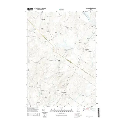
2014 Map of North Pownal
USGS Topo · Published 2014About this map
The Androscoggin and Cumberland county line bisects this Maine landscape, where the Androscoggin River flows past the northeastern corner at South West Bend. This 2014 survey documents a region defined by high points like Bradbury Mountain, Tryon Mountain, and Pisgah Hill, interspersed with small settlements such as North Pownal, West Pownal, and Pownal Center. The map is particularly useful for genealogical research, identifying numerous family-named burial grounds including Plummer Cem, McKenney Cem, and the Old Friends Cem. The area’s aviation and recreation interests are represented by Margerison Airport and the waters of Runaround Pond. Numerous brooks, such as Chandler Brook and Libby Brook, drain the wooded terrain between these historic rural centers.
Find a feature on this map
110 named features on this map. Tap any name to fly to it.
Don’t see what you’re looking for? This feature index may not catch every label — zoom into the map to look around manually.
Map Details
Editions of this 2014 North Pownal Map
This is the sole edition of this map. No revisions or reprints were ever made.
Other maps of this area

1892 · Freeport
USGS Topo · 1:62,500

1894 · Gray
USGS Topo · 1:62,500

1898 · Gray
USGS Topo · 1:62,500

1908 · Poland
USGS Topo · 1:62,500

1908 · Lewiston
USGS Topo · 1:62,500

1940 · Poland
USGS Topo · 1:62,500

1941 · Freeport
USGS Topo · 1:62,500

1942 · Lewiston
USGS Topo · 1:62,500

1942 · Poland
USGS Topo · 1:62,500

1942 · Gray
USGS Topo · 1:62,500