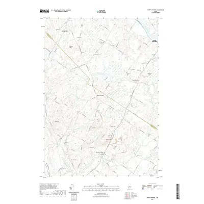
2021 Map of North Pownal
USGS Topo · Published 2021About this map
North Pownal and Pownal Center serve as the primary hubs in this modern topographic landscape, where the rural character is defined by a high density of small family and community burial grounds. These sites, including the Old Friends Cem and Harmony Grove Cem, are scattered across a terrain shaped by the Androscoggin River and its numerous tributaries. High points like Bradbury Mtn and Tryon Mtn provide significant relief above the surrounding valleys of Runaround Brook and Chandler Brook. The presence of Margerison Airport and a network of named roads like Royalsborough Rd and Pownal Rd indicate the area's continued integration between the local townships and the larger city of Auburn. The concentration of cemeteries throughout this quadrangle suggests a deeply rooted local history and long-standing family settlements that have persisted as the region transitioned into its modern layout.
Find a feature on this map
116 named features on this map. Tap any name to fly to it.
Don’t see what you’re looking for? This feature index may not catch every label — zoom into the map to look around manually.
Map Details
Editions of this 2021 North Pownal Map
This is the sole edition of this map. No revisions or reprints were ever made.
Other maps of this area

1892 · Freeport
USGS Topo · 1:62,500

1894 · Gray
USGS Topo · 1:62,500

1898 · Gray
USGS Topo · 1:62,500

1908 · Poland
USGS Topo · 1:62,500

1908 · Lewiston
USGS Topo · 1:62,500

1940 · Poland
USGS Topo · 1:62,500

1941 · Freeport
USGS Topo · 1:62,500

1942 · Lewiston
USGS Topo · 1:62,500

1942 · Poland
USGS Topo · 1:62,500

1942 · Gray
USGS Topo · 1:62,500