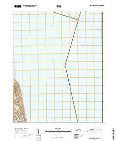
2019 Map of North Virginia Beach
USGS Topo · Published 2019About this map
North Virginia Beach and the northern reaches of Virginia Beach occupy the narrow coastal strip shown here, where the urban grid meets the vast expanse of the Atlantic Ocean. The landscape transitions from the residential streets of North Linkhorn Park to the wooded terrain of The Desert, reflecting the preservation of natural areas amidst dense coastal development. The maritime significance of the region is evident in the offshore Cape Henry Channel and the small coastal inlet of Rainey Gut. Major thoroughfares like Atlantic Ave, Ocean Front Ave, and Shore Dr serve as the primary arteries for this resort and residential community, while Atlantic University stands as a notable institutional landmark. The map also delineates the maritime boundary for Northampton Co to the north across the water.
Find a feature on this map
22 named features on this map. Tap any name to fly to it.
Don’t see what you’re looking for? This feature index may not catch every label — zoom into the map to look around manually.
Map Details
Editions of this 2019 North Virginia Beach Map
This is the sole edition of this map. No revisions or reprints were ever made.
Other maps of this area

1893 · Virginia Beach
USGS Topo · 1:125,000

1907 · Norfolk
USGS Topo · 1:125,000

1918 · Cape Henry
USGS Topo · 1:62,500

1919 · Cape Henry
USGS Topo · 1:62,500

1943 · Richmond
USGS Topo · 1:250,000

1946 · Eastville
USGS Topo · 1:250,000

1946 · Currituck Sound
USGS Topo · 1:250,000
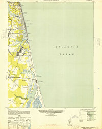
1948 · Virginia Beach
USGS Topo · 1:24,000
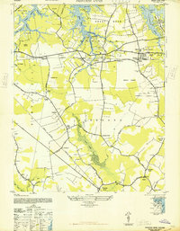
1948 · Princess Anne
USGS Topo · 1:24,000

1949 · Richmond
USGS Topo · 1:250,000