Loading...
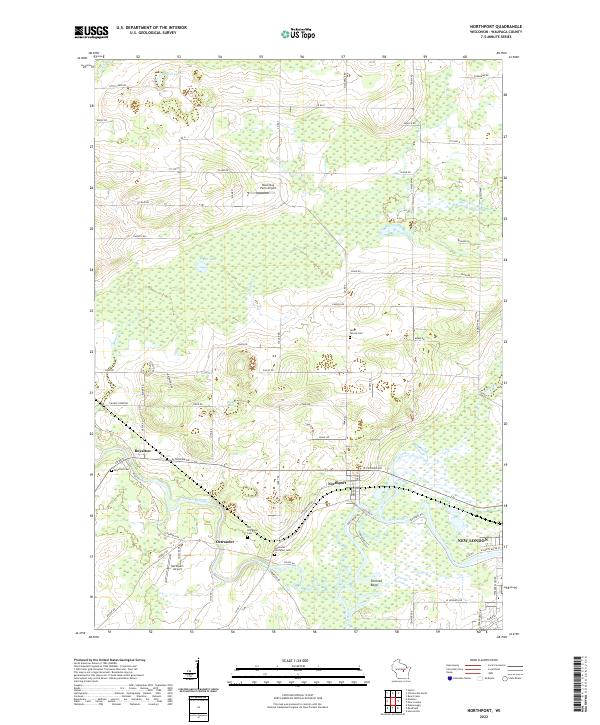
Loading map...2022 Map of Northport
USGS Topo · Published 2022About this map
The Little Wolf River and Wolf River converge in this corner of Waupaca County, defining a landscape of low-lying wetlands and scattered rural settlements. The confluence near Northport and Ostrander shows a complex network of river bends and oxbows, including the distinctive Shirt-tail Bend. This modern topographic survey illustrates how the area's geography remains centered on its waterways and small aviation sites like the Northport Airport and Black Dog Farm Airport.
Find a feature on this map
78 named features on this map. Tap any name to fly to it.
Don’t see what you’re looking for? This feature index may not catch every label — zoom into the map to look around manually.
Map Details
Date Portrayed2022
Date Published2022
PublisherU.S. Geological Survey
Map TypeTopographic
Scale1:24000
Physical Dimensions24 x 29 inches
Editions of this 2022 Northport Map
This is the sole edition of this map. No revisions or reprints were ever made.
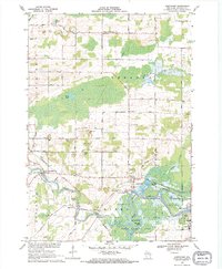
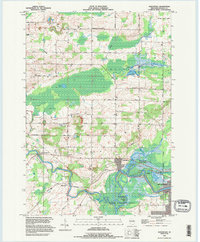
Historical Maps of Lebanon Through Time
3 maps found
Featured Locations
Source Details
SourceU.S. Geological Survey
CopyrightPublic Domain