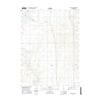
2017 Map of Norton Canyon
USGS Topo · Published 2017About this map
Salmon Falls Cr Reservoir dominates the northwestern corner of this Twin Falls County landscape, where the water reaches into Nortons Bay and creates prominent shoreline features like Saddle Point and Crappie Point. The terrain is defined by the significant rise of Browns Bench and the carved depths of Norton Canyon. This area is heavily influenced by its water sources, with several vital points including Threemile Spring, Rabbit Spring, and Twin Springs mapped across the high ground. The drainage network of Salmon Falls Cr and Twin Springs Cr reveals a complex series of draws and ridges, accessible by tracks like Norton Bay Rd. The map illustrates a remote section of southern Idaho where seasonal water and elevation changes dictate the use of the land.
Find a feature on this map
17 named features on this map. Tap any name to fly to it.
Don’t see what you’re looking for? This feature index may not catch every label — zoom into the map to look around manually.
Map Details
Editions of this 2017 Norton Canyon Map
This is the sole edition of this map. No revisions or reprints were ever made.
Other maps of this area

1955 · Twin Falls
USGS Topo · 1:250,000

1955 · Wells
USGS Topo · 1:250,000

1957 · Contact
USGS Topo · 1:62,500

1957 · Delaplain
USGS Topo · 1:62,500

1958 · Wells
USGS Topo · 1:250,000

1958 · Twin Falls
USGS Topo · 1:250,000

1961 · Wells
USGS Topo · 1:250,000

1977 · Browns Bench South
USGS Topo · 1:24,000

1977 · Rogerson
USGS Topo · 1:24,000

1977 · Magic Hot Springs
USGS Topo · 1:24,000